
Elevation 2,650 m (8,690 ft) Area 65.31 km² | City Bogotá D.C. Website Official website Population 449,621 (2016) | |
 | ||
Time zone Colombia Standard Time (UTC-5) | ||
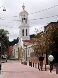
Usaqu n places to go in bogota bogotatravelguide com
Usaquén is a residential and commercial locality (district) in northern Bogotá, capital of Colombia. Although it is designated on maps as Bogotá's #1 locality, it was a separate municipality of Cundinamarca until 1954, when it was annexed into the city. Today, Usaquén is home to more than 480,000 inhabitants as projected by 2008. The Cordillera Oriental forms a natural border to the east.
Contents
- Usaqu n places to go in bogota bogotatravelguide com
- Map of UsaquC3A9n BogotC3A1 Bogota Colombia
- Borders
- Sites of interest
- History
- Neighbourhoods
- Parks
- Education
- References
Map of Usaqu%C3%A9n, Bogot%C3%A1, Bogota, Colombia
Borders
North: The municipality of Chía
East: The municipality of La Calera
South: The locality of Chapinero
West: The locality of Suba
Sites of interest
History
The name comes from the cacique Usaque, who was ruling the area of the Muisca. Usaque in Chibcha means "under the pole". In 1537 conquistador Gonzalo Jiménez de Quesada and his troops arrived on the Bogotá savanna. Usaquén was abandoned by Spanish decree in 1777. It was gradually repopulated by people from Bogotá, and was host to some fighting during the war for Colombian independence. It was re-founded as a municipality in 1846, and in 1860 it was the scene of a battle between government troops and Tomás Cipriano de Mosquera. After winning that battle, Cipriano took power of the country.
Until 1954, the municipality covered 71 km², starting from Avenida España in the south and ending at 12 km on the road to Chía. It had traditionally been a spot for Bogotá's elites to maintain country homes. When it was integrated into the city, it maintained many of its municipal institutions, but with the supervision of Bogotá's mayor. Under the new constitution of 1991, Bogotá was reorganized into localities. Usaquén was numbered first of twenty.
On December 31, 1978, the guerrilla group M-19 took the military base called Cantón Norte, robbing the arsenal.
Neighbourhoods
Among the important neighbourhoods are: Lijacá, Verbenal, San Antonio, Servitá, San Cristóbal Norte, Toberín, Cedritos, Bella Suiza, La Carolina, Santa Ana, Santa Barbara, San Gabriel Norte, Cantón Norte, Francisco Miranda, Las Margaritas, San Patricio and the old village of Usaquén.
Parks
Torca, located at the extreme north, is the locality's largest park. The Country Club's polo area was acquired by the District and transformed into a metropolitan park for northern Bogotá.
Education
Gimnasio Alessandro Volta, a private Italian international school, is in Usaquén.