
Native name Rio Urubu | Length 430 km | |
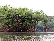 | ||
Urubu River (Portuguese: Rio Urubu) is a river in Amazonas state in north-western Brazil. It is a tributary of the Amazon River, and it branches to the north (or to the left if facing downstream) near the town of Itacoatiara. It is a blackwater river.
Contents
Map of Rio Urubu, Silves - State of Amazonas, Brazil
Course
The source of the Urubu is to the north of Presidente Figueiredo, where it is protected by the 374,700 hectares (926,000 acres) Caverna do Maroaga Environmental Protection Area, established in 1990. It flows in a southwest direction, parallel to the Uatumã River. In the municipality of Rio Preto da Eva the river forms the northeast boundary of the 27,342 hectares (67,560 acres) Rio Urubu State Forest, created in 2003. The river ultimately flows into Lake Urubu, which is connected by several channels to the Amazon River. The Urubu River discharges into the Amazon via the Preto da Eva River and the Uatumã River.