
Population 437 (2009) | Highest point Mt Qusetowqas Area 39 km² | |
 | ||
Archipelago Vanuatu, Torres Islands | ||
Vanuatu ureparapara island in the banks
Ureparapara (also known as Parapara for short) is the third largest island in the Banks group of northern Vanuatu, after Gaua and Vanua Lava.
Contents
- Vanuatu ureparapara island in the banks
- Map of Ureparapara Vanuatu
- History
- Geography
- Population
- Name
- Historical sites
- References
Map of Ureparapara, Vanuatu
Vanuatu ureparapara island in the banks
History
The first recorded European who arrived to Ureparapara was the Spanish explorer Pedro Fernández de Quirós on 15 June 1606. He first named the island Pilar de Zaragoza; however, later on, it is charted as Nuestra Señora de Montserrate both by him and his chaplain Fray Martin de Munilla.
Geography
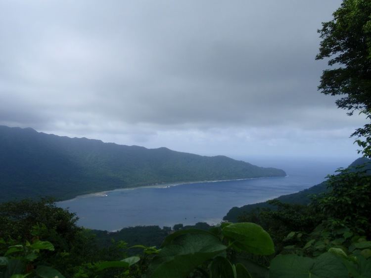
Ureparapara island is an old volcanic cone that has been breached by the sea on its east coast, forming Divers Bay. Apart from this indentation, the island is circular in shape, with a diameter of fifteen kilometres (9.3 miles). The land area is 39 square kilometres (15 square miles).
Population
The population was 437 in 2009. There are three villages on the island. The main village is Léar (Leserepla). The others are Lehali (on the west coast) and Leqyangle.
Two languages are traditionally spoken on the island, Löyöp and Lehali.
Name
The name Ureparapara reflects the way the island is named in the language of Mota, which was once chosen by missionaries, at the end of the 19th century, as the reference language for the area.
The island is locally named Noypēypay [nɔjpejˈpaj] in Lehali, and Aö [aˈø] in Löyöp
Historical sites
Ureparapara is known to host historical sites made of coral stone, named nowon and votwos in Lehali. These ancestral villages, located inland in the forest, were abandoned in the 19th century, yet have been preserved under the vegetation; they have been proposed for inclusion amongst the World Heritage sites of UNESCO. One of the most famous sites is a 12-feet high stone platform called Votwos. These used to serve as a ceremonial platform for the high-profile grade-taking ceremonies, known as sok or nsok in Lehali, and referred to in the anthropological literature as suqe or sukwe (after their name in Mota).
These sites are now only visited for ceremonial purposes, as most people nowadays live along the coast.