
Population 7,876 (2015 Est) Website Upper Lachlan Area 7,102 km² | Established 2004 Founded 2004 | |
 | ||
Points of interest Blue Mountains National, Wombeyan Caves, Lindner Quality Socks, Mares Forest National Destinations Blue Mountains National, Wombeyan Caves, Crookwell, Abercrombie River National, Collector - New South Wales | ||
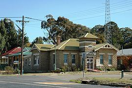
Upper Lachlan Shire is a local government area in the Southern Tablelands region of New South Wales, Australia. The Shire was formed in February 2004 from Crookwell Shire and parts of Mulwaree, Gunning and Yass Shires.
Contents
- Map of Upper Lachlan Shire NSW Australia
- Towns and localities
- Current composition and election method
- References
Map of Upper Lachlan Shire, NSW, Australia
The Mayor of Upper Lachlan Shire Council is Cr. Brian McCormack, an unaligned politician.
Towns and localities
The shire includes the towns of Crookwell, Gunning, Taralga, Bannaby, Dalton, Binda, Bigga, Tuena, Breadalbane, Cullerin, Laggan and Oolong.
Current composition and election method
Upper Lachlan Shire Council is composed of nine Councillors elected proportionally as one entire ward. All Councillors are elected for a fixed four-year term of office. The Mayor is elected by the Councillors at the first meeting of the Council. The most recent election was held on 10 September 2016, and the makeup of the Council is as follows:
The current Council, elected in 2016, in order of election, is: