
Country India Headquarters Anini Literacy 64.8% | State Arunachal Pradesh Area 9,129 km² | |
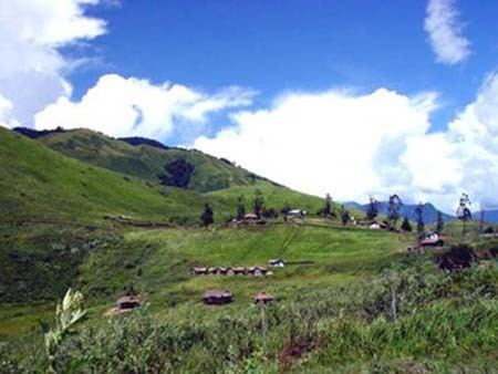 | ||
Upper Dibang Valley (Pron:/dɪˈbæŋ/) is a district of Arunachal Pradesh named after the Dibang River or the Talon as the Mishmis call it. Although the Dibang Valley district is the largest district in the state with an area of 9,129 square kilometres (3,525 sq mi), it is the least populated district in India.
Contents
- Map of Dibang Valley
- History
- Geography
- Transport
- Divisions
- Demographics
- Religion
- Languages
- Flora and fauna
- References
Map of Dibang Valley
History
In June 1980, Dibang Valley district was created out of part of Lohit district. On 16 December 2011, Dibang Valley district was bifurcated into Upper Dibang Valley district and Lower Dibang Valley district.
Geography
The river originates in the mountains of China and flows through the length of the valley which is named after it. The capital of this district, Anini, is the northernmost district capital in Northeast India. This district contains the northernmost point of Northeast India.
Transport
The 2,000-kilometre-long (1,200 mi) proposed Mago-Thingbu to Vijaynagar Arunachal Pradesh Frontier Highway along the McMahon Line, (will intersect with the proposed East-West Industrial Corridor Highway) and will pass through this district, alignment map of which can be seen here and here.
Divisions
There is only one Arunachal Pradesh Legislative Assembly constituency in this district: Anini. It is part of Arunachal East Lok Sabha constituency.
Demographics
According to the 2011 census Dibang Valley district has a population of 7,948, roughly equal to the nation of Nauru. This gives it a ranking of 640th in India (out of a total of 640). The district has a population density of 0.8 inhabitants per square kilometre (2.1/sq mi) .With this, it is also the most sparsely populated district in India. Its population growth rate over the decade 2001–2011 was 9.3%. Dibang Valley has a sex ratio of 808 females for every 1000 males, and a literacy rate of 64.8%.
The major population of this district consist of Mishmi (Idu).
The Mishmis have a story narrating the first journeys undertaken in course of migration. The story conveys names and location of the Cheethu-Huluni or the twelve rivers that the Mishmi (Idu) people came over in the region and settled around. The first accounts of the Mishmi (Idus) are found in the narrations given by the neighbouring Ahoms. The Mishmis inhabited the deep jungles of what is now the Dibang valley.
Religion
Total population: 7,272 (2001)
Languages
Languages spoken include Mishmi, a Sino-Tibetan tongue with approximately 25000 speakers, written in both the Tibetan and Latin scripts.
Flora and fauna
The district is rich in wildlife. Rare mammals such as Mishmi takin, Red goral and Gongshan muntjac occurs while among birds there is the rare Sclater's Monal. A flying squirrel, new to science has been recently discovered from this district. It has been named as Mishmi Hills Giant Flying Squirrel Petaurista mishmiensis.
In 1991 Upper Dibang Valley district became home to the Dibang Wildlife Sanctuary, which has an area of 4,149 km2 (1,601.9 sq mi).