
District Neuwied Elevation 56 m (184 ft) Area 8.16 km² Population 4,993 (31 Dec 2008) Dialling code 02224 | Municipal assoc. Unkel Time zone CET/CEST (UTC+1/+2) Local time Sunday 1:12 PM Postal code 53572 | |
 | ||
Weather 17°C, Wind NW at 11 km/h, 53% Humidity | ||
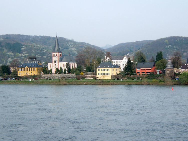
Unkel is a town in the district of Neuwied, in Rhineland-Palatinate, Germany. It is situated on the right bank of the Rhine, near Remagen, about 20 km southeast of Bonn.
Contents
- Map of Unkel Germany
- Religion
- Location
- Neighbouring settlements
- Subdivisions
- Sights
- Twin town
- Famous townsfolk
- References
Map of Unkel, Germany
Unkel is the seat of the Verbandsgemeinde ("collective municipality") Unkel.
Religion
Unkel is mainly Roman Catholic. Approximately 55% of the inhabitants are Roman Catholic and 15% Protestant. 18% of the residents do not belong to a religious denomination, 8% are Muslim.
Location
The town is located at the edge of the Rhine-Westerwald Nature Park in the middle Rhine Valley, its centre is about 4 km away from the border to North Rhine-Westphalia.
Neighbouring settlements
Unkel is surrounded from north to south by the settlements of Rheinbreitbach, Bruchhausen, Windhagen, Linz, Erpel und Remagen.
Subdivisions
Unkel has three subdistricts: Unkel, Scheuren and Heister.
Sights
The most important sight is the "Freiligrathaus", which is located at the Rhine promenade. It is a baroque palace, built in 1760. Ferdinand Freiligrath lived there from 1839 until 1841.
The rich-featured Catholic parish church "St. Pantaleon" accommodates a feretory (a receptacle for the relics of saints). Additionally, most of the old town wall is well preserved.