
Admin. region Arnsberg Elevation 67 m (220 ft) Area 40.93 km² Local time Saturday 10:56 AM Administrative region Arnsberg | Time zone CET/CEST (UTC+1/+2) Population 44,622 (30 Jun 2010) Dialling code 02307 Team VfL Kamen | |
 | ||
Weather 10°C, Wind W at 27 km/h, 89% Humidity | ||
Kamen is a town in North Rhine-Westphalia, Germany, in the district Unna.
Contents
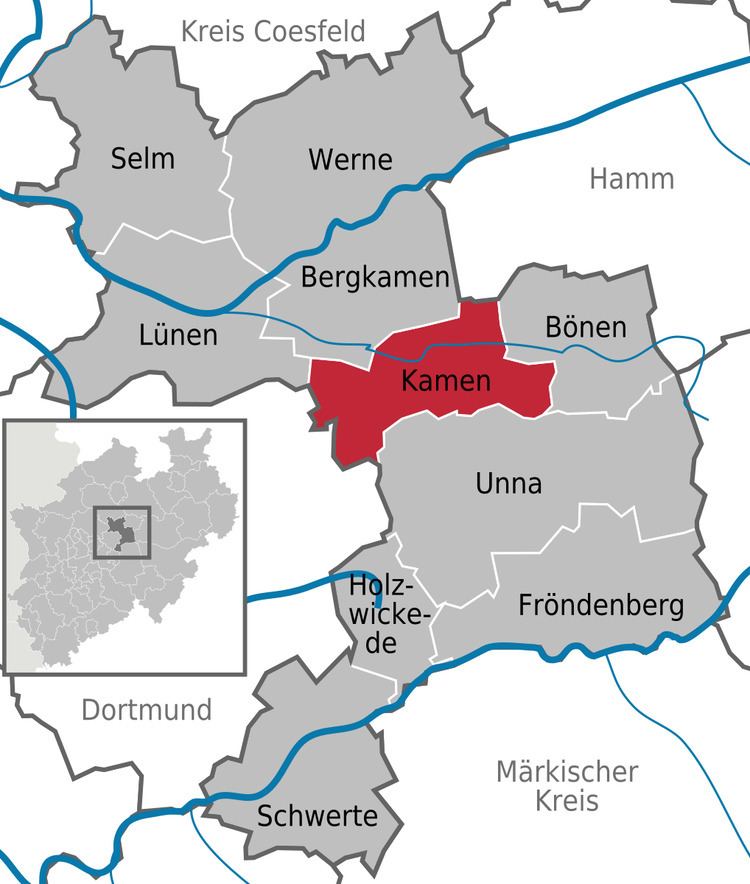
- Map of Kamen Germany
- Geography
- Neighbouring cities towns and municipalities
- Division of the town
- Council of the City
- Mayor
- International relations
- Transportation
- Sports
- Sons and daughters of the town
- References
Map of Kamen, Germany
Geography
Kamen is situated at the east end of the Ruhr area, approximately 10 km south-west of Hamm and 25 km north-east of Dortmund.
Neighbouring cities, towns, and municipalities
Division of the town
The town of Kamen consists of the following 6 districts:
Council of the City
Elections held in May 2014.
Mayor
Hermann Hupe (born 1950) (teacher), was elected mayor in 2003 with 55,1 % of the votes, he was reelected in 2009 and 2014.
International relations
Kamen is twinned with:
Transportation
Kamen is maybe most known because of the nearby highway crossing, the Kamener Kreuz. The north-south directed A1 meets the east-west directed A2; due to the importance of both highways the crossing is prone for traffic jams.
Sports
The village Kamen-Methler is well known for its football training camps. The German football team prepared themselves for the 1990 World Cup win in Kamen-Methler. During the soccer world championship 2006 in Germany the Spanish football team lived there.