
 | ||
Undivided Kamrup district is a former administrative district located in Western Assam from which Kamrup Rural (2003), Kamrup Metropolitan (2003), Barpeta (1983), Nalbari (1985) and Baksa (2004) Kamrup South (2015) districts were formed. It was large administrative district in colonial times that has been reducing its size in subsequent periods.
Contents
Establishment
The administrative district of Kamrup was first constituted from the western portion of the Burmese Empire that the British acquired following the Treaty of Yandaboo of 1826. The western boundary of this district was the Manas river, and the eastern boundary of this district was the Barnadi river. After 1826 the British administered the newly acquired regions via two commissioners: the Senior Commissioner who administered the "North-East of Rangpur" (largely the undivided Goalpara) in addition to the newly acquired region between Manas river and Biswanath; and the Junior Commissioner, who administered the region to the east of Biswanath. In March 1833 the British established district administration in the region west of the Dhansiri river, with the Kamrup district originally envisaged as two separate districts among 3 others: the six parganas largely co-terminus with present-day Barpeta and Nagarberra; and the twenty parganas in the north and six duars in the south. Each district were to be administered by a Principal Assistant, deputed by a Junior Assistant. But due to a paucity of funds, the six pargana region had only a Junior Assistant, and by 1836, the Kamrup district acquired its "undivided" form and name.
After the independence of India in 1947 the "undivided" Kamrup district was divided into the present Barpeta district (1983), Nalbari district (1985). In 2003 Kamrup was bifurcated into Kamrup Metropolitan district and Kamrup Rural district. In 2004 the northern parts of Barpeta, Nalbari and Kamrup Rural district were constituted into Baksa district.
Ancient
The history of the undivided Kamrup district dates backs to the 4th century under Kamrup Kingdom. The capitals of Varman Dynasty and Pala Dynasty namely Pragjyotishpura and Durjaya were in Kamrup. Undivided Kamrup district was roughly equivalent to Kampith of ancient Kamarupa Pithas. Kampith is known as Kamarupa or Kamrup before the title spread to larger areas. It is also known as Pragjyotisha in different epics. Kamrup is mentioned in the Allahabad Pillar inscription of Samudragupta as one of the frontier states outside the limits of Gupta Empire with its capital at Pragjyotishpura which was 30 li in size. Chinese pilgrim Yuan Chwang mentions that land was low and moist, crops grows regularly, climate was quite genial and people are honest. He finds no trace of Buddhism while Deva temples are widespread. He said king (Bhaskar Varman) was lover of learning. Though himself an Hindu, he treat Buddhist monks with respect.
Medieval
Medieval times seen the period when Kamrup became battleground of different scrambling western and eastern powers. Banikanta Kakati says: "Western Assam was never for a long period under any dominant power. It was the cockpit of several fighting forces, the Koches, the Muhammedans and the Ahoms, and political fortunes passed from one power to another in different times."
Part of Koch Hajo
Kamata kingdom undertook control of western Kamrup after conclusion of Kamarupa kingdom. Towards the end of the first century of second millennium, Kamrup witnessed invasions by Muslim rulers of Bengal. In 1498 CE, the last ruler of Kamata Kingdom was overthrown by Hussein Shah, ruler of Bengal. Hussein Shah, after this victory declared them self as the Conqueror of Kamru or Kamru ( In Arabic alphabet there is no P, hence the Muslim rulers mention Kamrup as Kamru or Kamrud). Hussein Shah, later faced defeat when he invaded Ahom kingdom and the victorious Ahom army chased the invaders till Karatoya river.
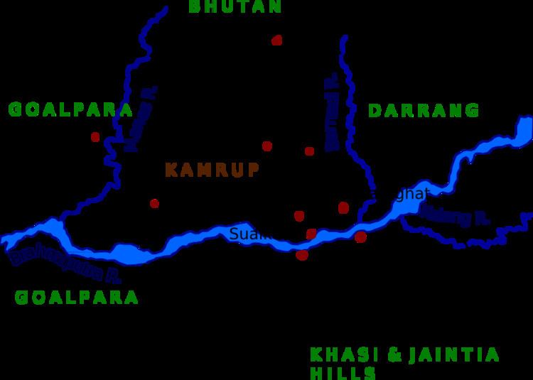
The British districts of Goalpara, Kamrup and Darrang constituted the Koch Hajo of the 16th-17th century, then ruled by the descendants of Chilarai of the Koch dynasty. Following a period of Ahom-Mughal conflicts and the concluding Battle of Itakhuli of 1682 the Manas river became the Ahom-Mughal boundary, and as a result, Koch Hajo was divided largely into three parts: the region west of Manas river, under the control of the Mughals (later Goalpara district); the region between the Manas and Barnadi, under the command of the Borphukan (later Kamrup district); and the region to the east, under the vassalage of the descendants of Balinarayana of the Koch dynasty who reported to the Borphukan (later Darrang district).
Borphukan's domain
After the departure of Muslim forces, the power vacuum was filled by Koch dynasty, when Koch king Vishwa Singha and later his sons Narnarayan and Chilarai expanded their domain in these regions. It was during the reign of Koch dynasty, Vaisnava reformers Sankardev and Madhavdeva spread their ideals and Vaisnava culture in the region, which is still very much present till date. The Koch kingdom later divided into two parts, Koch Bihar and Koch Hajo. Kamrup falls into the domain of Koch Hajo. In 1612 CE, the last ruler of Koch Hajo, Parikshit Narayan was defeated by Mughals. He was taken prisoner and sent to Delhi, where he swore allegiance to Mughal Emperor Jahangir. After his death, the Mughals occupied Kamrup and made Hajo their headquarters. Parikshit's son Bijit Narayan was installed as a tributary ruler of Bijni. The two brothers of Parikshit Narayan, Bali Narayan and Gaj Narayan sought refuge in Ahom kingdom. The Ahom king Swargadeo Pratap Singha installed Bali Narayan as tributary ruler of Darrang, while Gaj Narayan was installed as the tributary ruler of Beltola. Meanwhile conflicts broke out between Ahoms and Mughals for the possession of Kamrup. A series of wars and battles fought by both sides, which includes the famous Battle of Saraighat, when the Ahom forces led by Lachit Borphukan defeated the Mughal forces led by Ram Singh I of Amber, in 1671 CE. Finally, in 1682 CE, the Mughals were completely expelled from Kamrup, by Ahom king Gadadhar Singha. From 1682 CE to 1820 CE, Kamrup remain as a part of Ahom Kingdom, with the Ahom Viceroy Borphukan administering the region from his headquarters in Guwahati. The Borphukan's domain fell to the Burmese invasion when Mingimaha Bandula arrayed from the east against the forces of Chandrakanta Singha in 1822 and pushed him beyond the Manas river before returning to Burma to prepare against the British in the same year. The region to the west of Manas had come under British rule following the transfer of the Bengal in 1765, and the British became concerned, leading to the First Anglo-Burmese War.
Colonial
In mid nineteenth century it was subsequently occupied by British East India Company. In 1826 CE, it became an district of British India, in the Brahmaputra Valley division of Eastern Bengal and Assam. During British rule, this settlement had been one of the peasant uprising center against the British. Armed peasants vowed to through British rule but eventually suppressed by British administration with iron fist.
Modern
Kamrup district has been steadily decreasing in size for decades. During British India at some point Kamrup was divided into two big districts for administrative reasons one added to Assam and other to Bengal which includes Cooch Behar and Jalpaiguri. In 1983 Barpeta district was split from Kamrup. Nalbari district was then similarly split off on 14 August 1985. On 3 February 2003 Kamrup Metropolitan district was formed to cover the urban core of the district, and 1 June 2004 saw the formation of Baksa district which was formed from parts of three districts, including Kamrup. The headquarters of district was at Guwahati. The population is rural and suburban with major urban agglomeration in Guwahati, the largest city of region.