
TE Kativik Time zone EST (UTC−5) Area 25.6 km² Province Québec Area code 819 | Constituted December 20, 1986 Postal code(s) J0M 1Y0 Population 444 (2011) Local time Friday 12:26 AM Number of airports 1 | |
 | ||
Weather -8°C, Wind SE at 14 km/h, 77% Humidity | ||
Red light hovering over umiujaq nunavik quebec canada
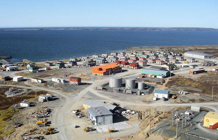
Umiujaq (Inuktitut: ᐅᒥᐅᔭᖅ) is a northern village (Inuit community) near the eastern shore of Hudson Bay in Nunavik in northern Quebec, Canada. The village was established in 1986 by Inuit from Kuujjuarapik, 160 km to the south, who decided to relocate away from the area affected by the James Bay Hydro-electric Project. The population in the Canada 2011 Census was 444. Umiujaq is the closest community to Tursujuq National Park, which was officially opened on July 18, 2013, and covers 26,106.7 km2 (10,079.9 sq mi).
Contents
Map of Umiujaq, QC, Canada
Umiujaq, meaning "which resembles a boat" in the Inuttitut language, is located at the foot of a hill resembling an overturned umiaq, a traditional Inuit walrus-skin boat. The village is located 15 km (9.3 mi) west of Richmond Gulf (French: Lac Guillaume-Delisle; Inuttitut: Tasiujaq (which resembles a lake)), an immense inland bay which is joined with Hudson Bay by a rocky glutch
Inaccessible by road, Umiujaq is served by the small Umiujaq Airport.
History
The Inuit negotiated a clause into the 1975 James Bay and Northern Quebec Agreement that provided for the relocation of the Inuit from Kuujjuarapik to a new settlement unaffected by hydro-electric development. Following a referendum, in 1982 the Inuit opted to create a new community where they could preserve their traditional lifestyle in an area where fish and game were not threatened by hydro-electric development. After extensive studies a location was selected, and construction of the new village was completed in 1986.