
Length 44 km | River mouth Vrbas268 m (879 ft) Basin size 328 km (127 sq mi) | |
 | ||
Main source Prelivode, Vlašić Mt.≈1,590 m (5,220 ft) Tributaries Right:Ugrić, Pljačkovac, Ilomska, Kobilja, Zirin potok, Kusin potok, Ugrić | ||
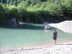
The Ugar (Brzica until 1878: ) is a river of Bosnia, a tributary of the Vrbas river. It appears at the slopes of Vlašić, upstream of Sažići and Melina villages (at around of 1590 meters above sea level), a watershed area of Vrbanja, Ilomska and Bila rivers.
Contents
Map of Ugar, Bosnia and Herzegovina
Geography and hydrology
The Ugar's length is around 44.5 kilometres, and its catchment is around 328 km2. Its largest right tributaries are: Pljačkovac, Ilomska, Kobilja, Zirin Potok and Kusin Potok (Ziro's and Kuso's creeks), and Ugrić; left tributaries are the creeks: namely Lužnica Potok, Dedića Potok, Andrijevića Potok, Bunar, Oraški Potok, and Kukavički Potok.
At its source Ugar and its headwaters tributaries creates series of waterfalls. After short, but deep canyon (below the Babanovac plateau) it enters into Pougarje, under the Ranča Mountain. By this, Ugar flows into a deep and long canyon under Skender Vakuf, around 20 kilometres downstream of Jajce. Notch of the Canyon is a very arduous and its maximal depth is (approximately) 500 m. The area in the valley along the Ugar, from Vitovlje to its Canyon is marked as Pougarje