Time zone CET/CEST (UTC+1/+2) Area 134.9 km² Local time Thursday 6:01 PM | Elevation 84 m (276 ft) Postal codes 04924, 04938 Population 6,007 (31 Dec 2008) Dialling code 035365 | |
 | ||
Weather 17°C, Wind W at 8 km/h, 59% Humidity Points of interest Saxon post milestone, Maasdorfer Teiche, Historische Mühle Wahrenbrück | ||
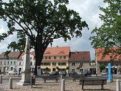
Uebigau-Wahrenbrück is a town in the Elbe-Elster district, in southwestern Brandenburg, Germany. It is situated on the river Schwarze Elster, 11 km northwest of Bad Liebenwerda, and 21 km east of Torgau.
Contents
Map of Uebigau-Wahrenbr%C3%BCck, Germany
Geography
The town is composed by the villages of Bahnsdorf, Beiersdorf, Beutersitz, Bomsdorf, Bönitz, Domsdorf, Drasdo, Kauxdorf, Langennaundorf, Marxdorf, München/Elster, Neudeck, Prestewitz, Rothstein, Saxdorf, Uebigau (municipal seat), Wahrenbrück, Wiederau, Wildgrube, Winkel and Zinsdorf.
Sons and daughters of the city
References
Uebigau-Wahrenbrück Wikipedia(Text) CC BY-SA
