
Existed: 1926 – present Length 281 km | Constructed 1926 | |
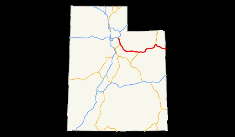 | ||
East end: US 40 at the Colorado state line (west of Dinosaur, CO) | ||
The west end of U.S. Route 40 is in the U.S. state of Utah at Silver Creek Junction in Silver Summit(about 20.7 miles (33.3 km) east of Salt Lake City) with Interstate 80. From there it heads southeast through Heber City and east into Colorado on its way to the Mid-Atlantic.
Contents
Route description
U.S. Route 40 begins at I-80 at Silver Creek Junction in Silver Summit, traveling south-southeast as a full freeway in a broad valley northeast of Park City. At the south end of the valley, Jordanelle Reservoir comes into view and US-40 continues south high on the slope above its western shore while Utah State Route 248 climbs away to the east on the slope overlooking the northern shore. The freeway passes through several large cuttings in the side of the mountains that were dug when US-40 was relocated to make way for the reservoir; Utah State Route 319 provides access down the slope to a state park on the shore of the reservoir. South of the reservoir, the dam is visible on the left and the road loses elevation quickly before abruptly connecting to a (suburban or exurban) non-freeway segment with frequent curb cuts and building frontage. In central Heber, U.S. Highway 189 continues south, but US-40 turns east to leave the city. US-40 continues south and east through mountains and the Uintah Basin to the Colorado border near Dinosaur National Monument.
History
As with most states, US-40 follows the Victory Highway through Utah. This auto trail was organized in 1921, and overlapped the older Lincoln Highway through Salt Lake City. To the west, it split from the Lincoln at Mills Junction, and took a straight path across the Great Salt Lake Desert on the proposed Wendover Cut-off to Nevada. The east split with the Lincoln was at Kimball Junction, where the Victory turned to the southeast over an old trail that led past Heber City, over Daniel's Pass, and along the Strawberry River and Duchesne River to Fort Robidoux. The highway continued east across a relatively flat area through Vernal to Colorado.
The Utah State Road Commission took over the highway from Kimball Junction to Colorado in 1910 and 1911; in late 1926, the American Association of State Highway Officials (AASHO) assigned US-40 to this cross-state route.
The old Lincoln Highway east of Kimball Junction was initially US-530, but in the late 1930s it became part of US-189. The split between US-40 and US-189, formerly the junction of the Victory and Lincoln Highways, was moved east from Kimball Junction to Silver Creek Junction in 1952; this change moved both routes to a new road between Keetley Junction and Silver Creek Junction, and renumbered the road between Kimball and Silver Creek Junctions from US-189 to US-40. The old road between Keetley and Kimball Junctions became State Route 248. In 1974, with its replacement - Interstate 80 - almost complete across California, Nevada, and Utah, the three states applied to AASHO to truncate US-40 to Silver Creek Junction. (US-40 had been removed west of Truckee, California in 1964.) AASHO approved the truncation on June 17, 1975.
After a bypass of Myton was built, the old route along Main and Sixth Streets became State Route 252 in 1953. It was given to the city in 1969.