Time zone CET (UTC+1) Area 86.54 km² Population 357 (1 Apr 2009) Area code 06471 | Elevation 1,233 m (4,045 ft) Vehicle registration TA Local time Monday 7:48 AM Postal code 5563 | |
 | ||
Weather -3°C, Wind E at 8 km/h, 85% Humidity Points of interest Fanningberg, Plattenspitze, Gurpitschegg | ||
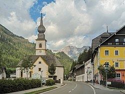
Tweng is a municipality in the district of Tamsweg in the state of Salzburg in Austria.
Contents
Map of Tweng, Austria
Geography
Tweng lies in the Lungau on the south side of the Radstädter Tauern.
References
Tweng Wikipedia(Text) CC BY-SA
