
 | ||
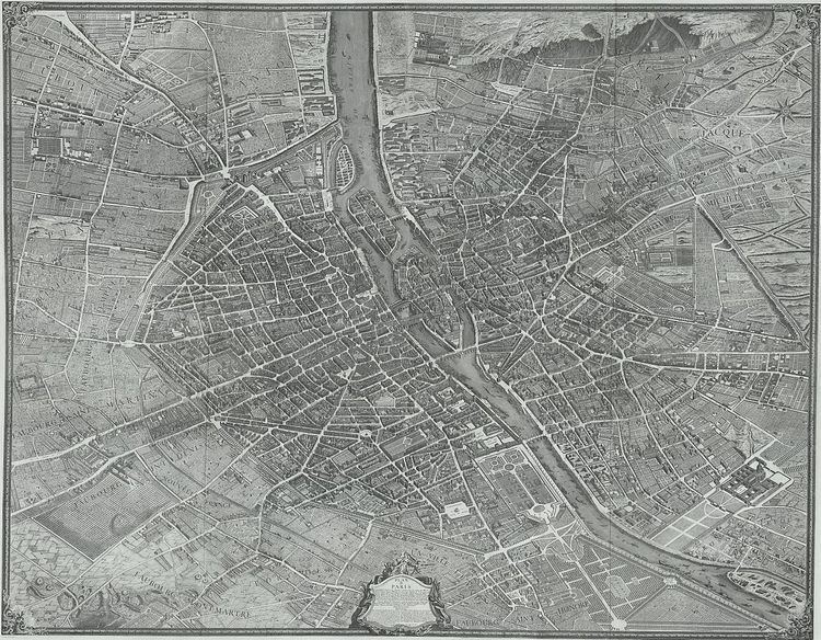
The Turgot map of Paris (French: plan de Turgot) is a highly accurate and detailed map of the city of Paris as it appeared in 1734–1736.
Contents
Description
The Turgot map was published in 1739 as an atlas of 20 non-overlapping sectional bird's-eye view maps (at a scale of approximately 1/400) in isometric perspective toward the southeast. Additionally, there is one simplified general map with a 4 x 5 grid showing the layout of the 20 sectional maps. The atlas covers an area approximately corresponding to the first eleven of the modern-day arrondissements. Each sectional map is 50 cm high (only 48 cm in the first row) by 80 cm wide and consists of double facing sheets. If the sectional maps are assembled, the composite is 250.5 cm high x 322.5 cm wide. It has been called "the first all-comprising graphical inventory of the [French] capital, down to the last orchard and tree, detailing every house and naming even the most modest cul-de-sac."
History
In 1734 Michel-Étienne Turgot, chief of the municipality of Paris as provost of merchants, decided to promote the reputation of Paris for Parisian, provincial or foreign elites by implementing a new map of the city. He asked Louis Bretez, member of the Royal Academy of Painting and Sculpture and professor of perspective, to draw up the plan of Paris and its suburbs.
By contract, Turgot requested a very faithful reproduction with great accuracy. Louis Bretez, was allowed to enter into the mansions, houses and gardens in order to take measurements and draw pictures. He worked for two years (1734-1736).
In the eighteenth century, the trend was to abandon portraits of cities (inherited from the Renaissance) for a geometric plan, more technical and mathematical. But the plan de Turgot goes against this trend, by choosing the system of perspective cavaliere: two buildings of the same size are represented by two drawings of the same size, whether the buildings are close or distant.
In 1736, Claude Lucas, engraver of the Royal Academy of Sciences, created the 21 sheets of the plan. The plan was published in 1739, and the prints were bound in volumes offered to the King, the members of the Academy, and the Municipality. Additional copies were to serve as representations of France to foreigners. The 21 engraved brass plates are kept by the Chalcography of the Louvre, where they are even now used for re-printing employing the same techniques as two centuries ago.