
Admin. region Oberbayern Elevation 508 m (1,667 ft) Area 68.98 km² Population 6,951 (31 Dec 2008) | Time zone CET/CEST (UTC+1/+2) Local time Sunday 3:53 PM Postal code 83104 | |
 | ||
Weather 12°C, Wind NE at 21 km/h, 38% Humidity | ||
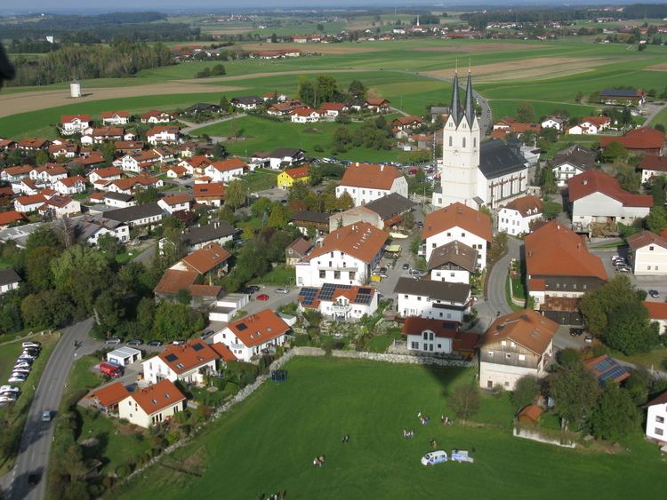
Tuntenhausen is a municipality in the district of Rosenheim in Bavaria in Germany.
Map of 83104 Tuntenhausen, Germany
There are 57 official districts of Tuntenhausen, namely Tuntenhausen itself, Antersberg, Aubenhausen, Bach, Berg, Beyharting, Biberg, Bichl (this Bichl is an Einöde), Bichl (this Bichl is a Weiler (hamlet)), Bolkam, Brettschleipfen, Dettendorf, Eggarten, Eisenbartling, Emling, Fischbach, Fuchsholz, Großrain, Guperding, Haus, Höglhaus, Hohenthann, Holzbichl, Hopfen, Hörmating, Innerthann, Jakobsberg, Karlsried, Knogl, Kronbichl, Lampferding, Mailling, Maxlrain, Moosmühle, Mühlholz, Neureith, Nordhof, Oberrain, Oed, Ostermünchen, Pangraz, Schlafthal, Schmidhausen, Schönau, Schwaig, Schweizerberg, Schweizerting, Seisrain, Sindlhausen, Söhl, Stetten (this Stetten is a Dorf (village)), Stetten (this Stetten is an Einöde), Thal, Unterrain, Voglried, Weiching, Weng.
Ostermünchen is a station of the Munich–Rosenheim railway and served about once per hour by local trains.
The town is known best for its church, a destination for Roman Catholic pilgrims in Bavaria.