
FIPS code 04-76010 Elevation 1,512 m Zip code 86045 Area code Area code 928 | Time zone MST (UTC-7) GNIS feature ID 0012802 Area 23.1 km² Population 8,611 (2010) | |
 | ||
Tuba City (Navajo: Tó Naneesdizí) is an unincorporated town in Coconino County, Arizona, on Navajo lands, in the United States. It is the second-largest community in Coconino County. The population of the census-designated place (CDP) was 8,611 at the 2010 census. It is the Navajo Nation's largest community, slightly larger than Shiprock, New Mexico, and the headquarters of the Western Navajo Agency. The Hopi town of Moenkopi lies directly to its southeast.
Contents
- Map of Tuba City AZ 86045 USA
- History
- Geography and climate
- Demographics
- Attractions
- Shops and services
- Education
- Sports
- Notable residents
- Tuba City in popular culture
- References
Map of Tuba City, AZ 86045, USA
The name of the town honors Tuuvi, a Hopi headman from Oraibi who converted to Mormonism. The Navajo name for Tuba City, Tó Naneesdizí translates as "tangled waters", which probably refers to the many below-ground springs that are the source of several reservoirs.
Tuba City is located within the Painted Desert near the western edge of the Navajo Nation. The town is situated on U.S. Route 160, near the junction with Arizona State Route 264. Tuba City is located about 50 miles (80 km) from the eastern entrance to Grand Canyon National Park. Most of Tuba City's residents are Navajo, with a small Hopi minority. It is located within Arizona's 1st Congressional District, currently represented by Ann Kirkpatrick.
History
The written history of the town dates back more than 200 years. When Father Francisco Garcés visited the area in 1776, he recorded that the Indians were cultivating crops. The town was named after Tuuvi, a Hopi leader. Chief Tuuvi converted to Mormonism circa 1870, and invited the Mormons to settle near Moenkopi.
Tuba City was founded by the Mormons in 1872. Tuba City drew Hopi, Navajo and Paiute Indians to the area because of its natural springs. In 1956, Tuba City became a uranium boomtown, as the regional office for the Rare Metals Corporation and the Atomic Energy Commission. The mill closed in 1966, and reclamation of the millsite and tailings pile was completed in 1990.
Geography and climate
Tuba City is located at 36°7′45″N 111°14′19″W (36.129044, -111.238718). According to the United States Census Bureau, the CDP has a total area of 8.9 square miles (23 km2), all land.
Geologically, Tuba City sits upon the Glen Canyon Group from the early Jurassic (about 180-210 Ma) and on modern superficial Quaternary deposits.
Arizona does not currently observe Daylight Saving Time, though the Navajo reservation does. In practice the community has a varied observance: tribal offices and schools observe DST, while most businesses do not.
Tuba City, owing to its location in the rain shadow of the Mogollon Rim which keeps out moisture from the Gulf of California, has a cold desert climate (Köppen BWk) with hot, dry summers—though less hot than Phoenix—and cold, dry winters. Frosts are normal from October to April but the majority of winters do not have measurable snowfall due to the dryness of the air descending from mountains to the south.
Demographics
As of the census of 2015, there were 9,722 people, 2,360 households, and 1,675 families residing in the CDP. The population density was 921.6 people per square mile (356.0/km²). There were 2,465 housing units at an average density of 274.0 per square mile (105.8/km²). The racial make-up of the CDP was 79.17% Native American, 4.36% White, 0.31% Black or African American, 0.8% Asian, 0.04% Pacific Islander, 0.63% from other races, and 1.47% from two or more races. 15.35% of the population were Hispanic or Latino of any race.
There were 2,360 households out of which 52.9% had children under the age of 18 living with them, 49.0% were married couples living together, 26.0% had a female householder with no husband present, and 17.7% were non-families. 15.1% of all households were made up of individuals and 2.3% had someone living alone who was 65 years of age or older. The average household size was 4.00 and the average family size was 4.49.
In the CDP, the age distribution of the population shows 42.8% under the age of 18, 9.8% from 18 to 24, 27.5% from 25 to 44, 15.7% from 45 to 64, and 4.3% who were 65 years of age or older. The median age was 23 years. For every 100 females there were 93.8 males. For every 100 females age 18 and over, there were 87.3 males.
Tuba City's median household income is $47,091, and the median income for a family was $37,813. Males had a median income of $29,280 versus $26,855 for females. The per capita income for the CDP was $14,140. About 23.1% of families and 28.2% of the population were below the poverty line, including 33.0% of those under age 18 and 44.8% of those age 65 or over.
Attractions
Shops and services
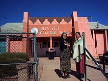
There is a flea market held every Friday just northeast of the Chapter House, off Peshlaki Avenue. The flea market offers a variety of Navajo and Hopi arts and crafts, as well as local foods, such as mutton sandwiches, piki, and frybread. Also there a Basha's supermarket, Sonic and McDonald's located on Main Street.
Tuba City Trading Post, a store selling Navajo handmade crafts, has a building dating from 1905. It is adjacent to the Navajo Interactive museum, and Navajo Code Talkers museum off of Main Street and Edgewater Drive.
The Hopi tribe opened the Tuuvi Travel Center in 2008, a $6.3 million complex. They opened a 13 million dollar motel in 2010 and Denny's restaurant in 2011 across the street on US Highway 160. The Hopis plan a $100 million "Gateway to Hopiland" nearby.
Tuba City is served by the Tuba City Airport.
Education
The area is served by the Tuba City Unified School District, as well as several independent schools within the area.
Schools in Tuba City include:
Sports
Tuba City High School was awarded the 1982 National Cross Country Championship through the XC Legacy series published through Milesplit.us in an effort to begin filling in the national rankings from 1980-1988. The Harrier Magazine, operated by Marc Bloom formerly of Runners World Magazine began keeping official rankings in 1989. The National Title is the first for historic Coach Bud Davis and caps off a remarkable season and school Legacy of eight straight state titles, eleven in thirteen seasons. Tuba City High School's varsity volleyball team are 2012 Champions. Also, Tuba City High School's Cross-Country team took 1st in the state in 2013. Tuba City National Title Top 3 Photo