
Population 35,467 (2003) | Region ChūbuHokuriku Local time Sunday 10:57 AM | |
 | ||
Website www.town.tsubata.ishikawa.jp Weather 9°C, Wind NE at 14 km/h, 68% Humidity Points of interest Ishikawaken Forest Park, Agata Park, Hill park with a view of the bull, Nakajo Park, Kurikarakentei Park | ||
Tsubata (津幡町, Tsubata-machi) is a town located in Kahoku District, Ishikawa Prefecture, Japan.
Contents
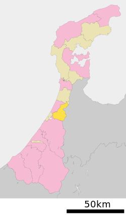
Map of Tsubata, Kahoku District, Ishikawa Prefecture, Japan
Tsubata is located near the middle of Ishikawa Prefecture. It plays an important role as a crossroads between the Kaga region, the Noto region, and Toyama Prefecture.
Tsubata’s total area is 110.44 square kilometers. To the east, valleys and dales branch out through the low hills, while a flat plain 2-3 kilometers in width spreads out to the west. Approximately 37,000 people reside in Tsubata. Beginning in 1970, the population grew by a modest 1% every year. Following the start of the Heisei Era in 1989, the rate of population growth increased. According to year 2000 census results, Tsubata’s total population increase and population growth rate were the highest in the prefecture. In the center of town limits lies Ishikawa Prefecture Forest Park, the largest park of its kind on the island of Honshu. Kahoku Lagoon, the largest lagoon in the prefecture, is located in southwest Tsubata.
The main part of town is located around the town hall. The old downtown shopping street (商店街), Puppy One, is located to the north, but is dying down and many businesses are moving more toward a newer part of town south of town hall. This area includes a large shopping center called Al Plaza, grocery stores, a number of restaurants and Cygnus, the cultural hall.
The mayor of Tsubata is Yata Tomiro.
There are 4 town mascots: Yoshinaka-kun(よしなかくん), Tomoe-chan (ともえちゃん), Ka-kun (カーくん) and Mo-chan(モーちゃん). They are modeled after a relatively famous, gruesome, possibly fictional battle that took place in the hills that lie between what are now Tsubata and Oyabe, the town next door. During the Genpei War (the war between Genji and Heike clans), a Genji general by the name of Kiso Yoshinaka (よしなかくん) is said to have faced a large Heike host here. The story goes that they defeated the Heike with a cunning plan – they drove bulls with flaming torches attached to their horns (カーくん and モーちゃん) into the enemy camp in the dead of night. The resulting panic caused many surprised soldiers to fall into the ravine below, and thus the Genji troops were able to continue.
The town crest is a stylized rendition of the characters for “Tsuba” (written in katakana as ツバ). The shape of a flying bird signifies Tsubata’s soaring industrial and cultural development, while the figure in the center, its feet firmly planted on the earth, represents stability of town management. The circle represents harmony and peace for the people of Tsubata.
The town logo is warm and soft, expressing Tsubata’s familiarity and friendliness. Overlaying the brightly shining sun, “1-2-3” (the English word “sun” sounds like the Japanese word for the number three, “san”) signifies Tsubata’s progress. Beneath the words are three lines. The green like symbolizes the richness of the greenery that grows throughout Tsubata. The dark blue line represents Tsubata’s bright blue sky, while the light blue line stands for the pure water that Tsubata’s rich natural environment provides.
The town bird is a swan. During the winter, you may see large groups of migrating swans flying overhead, or hanging out in the rice paddies to the west of town. The unique street signs also sport a swan motif.
Tsubata’s “famous” foods are kurikara soba and makomo-dake. The latter is a relative of wild rice, though it’s cultivated not for the grains, but for the base of the stalk, which has a mild flavor and a texture similar to bamboo shoots. Makomo is in season in October. There is also the annual マコモ投げ event at Shinrin Kouen, where people throw bunches of long makomo leaves like javelins, trying to be the one who achieves the greatest distance.
Natural features of Tsubata are Mount Sangoku, Kohokugata Lake and the Tsubata and Omi rivers.
There is a zoo in Tsubata's Shinrin Park which has a variety of local wildlife.
In Tsubata there are Tsubata Junior High School as well as Tsubata Minami Junior High School.
Elementary schools are: Jonan Elementary School, Inoe Elementary School, Chujo Elementary School, Tsubata Elementary School, Kariyasu Elementary School, Haginodai Elementary School, Kasano Elementary School, Agata Elementary School, Oshirodai Elementary School