
 | ||
Country Democratic Republic of the Congo | ||
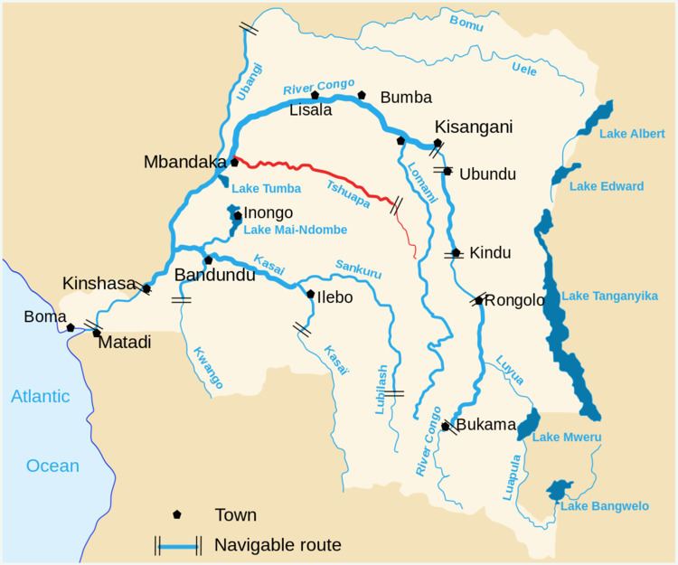
The Tshuapa River is a river in the Democratic Republic of the Congo, about 1000 km long. The middle Tshuapa is navigable and about 150 m across. It flows northwest from Katako-Kombe town to XX cataracts, then west to Mbandaka, where it merges with the Congo.
Contents
Map of Tshuapa, Democratic Republic of the Congo
After the meandering Tshuapa merges with the Lomela just west of Boende, it is generally called the Busira, and after merging with the Momboyo a hundred kilometers upriver from Mbandaka, the name of the last stretch of the river changes to Ruki.
Transport
The river is navigable from Ikela. Heading downstream, transport stops at Bokungu, Boende, Bokuka, Ikembeli, Bomputu, Bokote, Monyieka, Loolo, Lisafa, Lotoko, Ingende, Enyala, Basoko, and Mbandaka, before continuing on the Congo to Kinshasa.
References
Tshuapa River Wikipedia(Text) CC BY-SA