
Elevation 2,849 m | Prominence 109 m Parent peak Laaxer Stöckli | |
 | ||
Similar Fil de Cassons, Piz Segnas, Piz Dolf, Piz Sardona, Vorab | ||
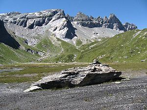
The Tschingelhörner (also spelled Tschingelhoren) are a mountain of the Glarus Alps, located on the border between the Swiss cantons of Glarus and Graubünden. They are composed of several summits on a 1 km long ridge, of which the highest is named Grosses Tschingelhorn (2,849 m). The mountain is located between Elm and Flims, west of the Segnas Pass (2,627 m). East of the main summit is a hole named Martinsloch.
Map of Tschingelh%C3%B6rner, 7017 Flims, Switzerland
The mountain is part of the Swiss Tectonic Arena Sardona and is a UNESCO World Heritage Site.
References
Tschingelhörner Wikipedia(Text) CC BY-SA