
 | ||
Similar | ||
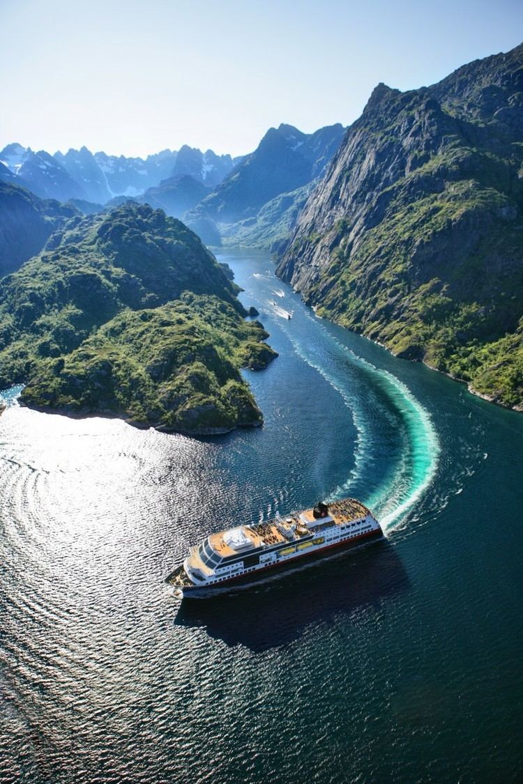
The Trollfjord (Trollfjorden) is a 2 km long sidearm of the Raftsund, is being claimed (as of 2016) to lie within one of the following two of Norway's traditional districts, Lofoten and Vesterålen. Administratively it's located in the municipality of vågan, which is a municipality in Lofoten With its narrow entrance and steep-sided mountains, Trollfjord cuts westwards from the Raftsundet strait. To the East of the fjord lies Austvågøya. The name is derived from troll, a figure from Norse mythology.
Contents
- Map of Trollfjorden 8324 Digermulen Norway
- Geography
- Tourist attraction
- Economy
- The Battle of Trollfjord
- References
Map of Trollfjorden, 8324 Digermulen, Norway
Geography
The mouth of the Trollfjord where it joins the Raftsund is only 100 meters wide. The fjord widens to a maximum width of 800 meters. The mountains surrounding Trollfjord are between 600 and 1100 metres high. It is surrounded by Trolltindan (1084 meter) in the south and Blåfjell (998 meter) and hohe Litlkorsnestinden (980 meter) in the north. The Trollfjord is 72 metres at its deepest point.
Tourist attraction
Hurtigruten's routes between Bergen and Kirkenes, detours into Trollfjorden. It is also popular with other cruise ferries.
Economy
Until 1960 there was a waterfall at the end of Trollfjord which is now redirected to produce hydroelectricity.
The Battle of Trollfjord
The Battle of Trollfjord (Trollfjordslaget) was fought in 1890 between the first industrial, steam-driven fishing ships and teams of traditional open-boat fishermen over access to the fjord. Johan Bojer described the battle in his 1921 novel The last of the Vikings (Den siste Viking).
A painting by Gunnar Berg, Trollfjordslaget depicts The Battle at Trollfjord. The painting is currently located in the Art Galleri Gunnar Berg on the island Svinøya in Svolvær town.