
Highest point Gulács | Terrain Lower mountains and hills Mountains Gulács | |
 | ||
Similar Alpokalja, Massif de Visegrád, Zemplén Mountains, Cserhát, Sopron Mountains | ||
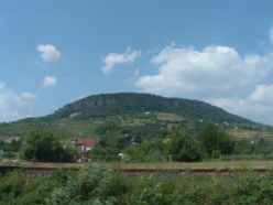
The Transdanubian Mountains (sometimes also referred to as Bakony Forest, Dunántúl Highlands, Highlands of Dunántúl, Highlands of Transdanubia, Mountains of Dunántúl, Mountains of Transdanubia, Transdanubian Central Range, Transdanubian Hills, Transdanubian Midmountains or Transdanubian Mid-Mountains, Hungarian: Dunántúli-középhegység) are a mountain range in Hungary covering about 7000 km². Its highest peak is the Pilis, with a height of 757 metres.
Contents
Map of Porva, Transdanubian Mountains, 8429 Hungary
Subdivisions
Visegrád Mountains are often considered a part of it for geopolitical reasons, but geographically they are part of the North Hungarian Mountains.
References
Transdanubian Mountains Wikipedia(Text) CC BY-SA