
 | ||
The trans gambia highway
The Trans-Gambia Highway is the most important road in The Gambia, running across the centre of the nation in a north-south direction. The road is also economically important for Senegal, in which it is designated as the N4 road.
Contents
Map of Trans-Gambia Hwy
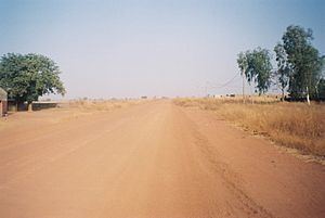
The Gambia is an elongated state forming a country that is almost surrounded by Senegal (but not an enclave, as it also borders the Atlantic Ocean). The Gambia almost separates the Casamance region from the remainder of Senegal. The Trans-Gambia Highway provides the most important connection between the two parts of Senegal. As the N4, it runs from Kaolack and Nioro, across Gambia and then into Bignona and Ziguinchor in the Casamance. The actual Gambian section is only 25 km long. It runs through Farafenni and Soma but the 800 metre width of the Gambia River can only be crossed by a connecting ferry.
With establishment of the Gambia River Development Organization in 1978, plans for a bridge were developed. Despite being repeatedly raised, these plans have not come to fruition.
In August 2005, the Gambia River Authority doubled the prices for the ferry crossing. In response, the Government of Senegal closed the border crossings. The prices were reduced at the beginning of October, but Senegal felt the issue was unresolved and threatened that they would construct a tunnel under Gambia, with the claimed support of China.
President of the Gambia Yahya Jammeh and President of Senegal Abdoulaye Wade met on 21 October 2005 and reached an agreement over the fare and a basis for its future calculation. The bridge construction project was again placed into the foreground.