Tralee Bay (Irish: Loch Foirdhreamhain / Cuan Thrá Lí) is located in on the west coast of County Kerry, Ireland. It is situated between Kerry Head on the north side and the Maharees on the west and extends eastwards as far as the bridge at Blennerville. Several small rivers feed into the bay through the town of Tralee. Villages around the bay include; Ballyheigue, Fenit, Kilfinora, Spa, Blennerville, Camp and Castlegregory.
The hinterland of Tralee Bay is rich in historic content covering most major eras in the origins and development of the Island and the Nation, from the mythological history, social and industrial development to relatively recent political evolution. In conjunction with Barrow Harbour, the following list of people, items, places and events are indicative and relevant;
Scotia's GraveCathair Cun RiRing Forts or RathsSou TerrainsSpaBlennervilleBlennerville WindmillSaint BrendanTralee Ship CanalSpanish ArmadaArdfert CathedralRoger CasementJeanie JohnstonCivil WarAudBee Hive HutsFenit HarbourIrish LightsRNLIMaharee IslandsDingle PeninsulaLiebherr Container CranesOyster BedsBird SanctuaryFenit ViaductFenit Railway Station and Branch LineMaps and charts
Ordnance Survey of Ireland, Discovery Series Map ref No. 71 Kerry. Scale 1:50,000British Admiralty Navigation Chart Ref No. 2739. Scale= 1:37,500.Place names and features
Generally, clockwise from Kerry Head;
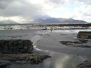
Kerry HeadBallyheigue PierBallyheigueBlackrockBanna StrandIllaunnabarnagh (rock)Mucklaghmore rockIllaunnacusha, rockCrow RockThe Rose rockBarrow Golf LinksFenit IslandBarrow HarbourLittle Samphire IslandSamphire LighthouseWheel RockBlack RockSpaTralee Ship CanalRiver Lee from TraleeBlennerville BridgeBlennerville WindmillBlennervilleBealathaleen CreekDerrymore IslandDerrymore StrandCarrigagharor PointAughacasla StrandCastlegregoryLough GillThe Trench RiverKilshshannig pointIllaunlea rockCallahangrin headlandRough PointMucklaghbeg rockMinnaun PointIllaunturlogh islandIllauntannig islandReennafardarrig islandIllaunboe islandIllaunimmil islandInishtooskert islandMagharee Islands or The Seven HogsThe MahareesScraggane BayMinnaunIllaunnanoonDoonagaun IslandA bird sanctuary is located on the south side of the bay on the low lying land of Derrymore Island.Little Samphire is a low-lying rock in the Bay on which a lighthouse stands. The lighthouse, operated and maintained by the Commissioners of Irish Lights also marks the limit of the harbour area under the control of Tralee and Fenit Harbour Board.Great Samphire Island is a small rock in the Bay around which is built the harbour and port of Fenit. The name comes from the rather rare yellow samphire plant that grows there. A monument to Saint Brendan the Navigator is located at the apex.Tralee Golf Club overlooks the whole bay from an elevated position at Barrow.Tralee Bay Sailing Club and a Sailing School, along with Fenit Marina provide leisure boating facilities.Shore based angling is a popular pastime practised from the viaduct leading out to the harbour.Several angling boats are licensed to take recreational anglers out on the bay.Tralee Bay Sea Angling Club, the largest sea angling club in Ireland, has its clubhouse in Fenit Harbour.Vessels sunk and wrecked
Integrity 13/3/1837. Lost off Brandon Head, en route from Tarbert to the Clyde.Audrey Anne 5/12/1998. 65 foot trawler lost off Brandon HeadBrothers 4/5/1841. A Dingle hooker carrying potatoes for the Protestant colony at DingleSaint Lawrence 7/2/1840. A barque went ashore at Ballyheigue Bay.Port Yarrock 29/1/1894. Sank in Brandon Bay, en route from Santa Rosilia, California. All 22 crew lost.See also "http://www.irishwrecksonline.net/Lists/KerryListB.htm" for much more detailed information.
Brandon Bay is the next bay to the south west and the Shannon Estuary is located to the north. Barrow Harbour is a bay located in the bay, east of Fenit Island.