
Peak Baurtregaum Provinces of Ireland Munster Highest point Baurtregaum Type of rock Sandstone | Length 19 km (12 mi) E-W Elevation 851 m Country Republic of Ireland Mountains Caherconree, Baurtregaum | |
 | ||
Similar Tralee Bay, Mount Brandon, Dingle Peninsula, Baurtregaum, Macgillycuddy's Reeks | ||
The Slieve Mish Mountains (Sliabh Mis in Irish) are a mountain range found in County Kerry in Ireland.
Contents
Map of Slieve Mish Mountains, Lassaboy, Co. Kerry, Ireland
GeographyEdit
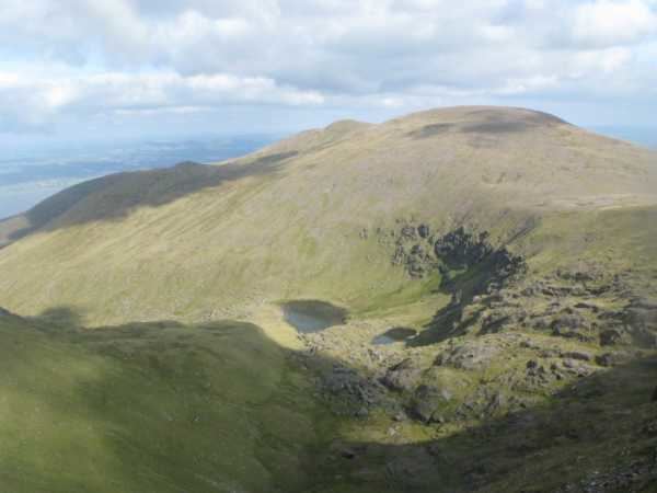
Overlooking Tralee Bay on the northern side and Dingle Bay on the south, they extend for approximately 19 km from east to west. They run from the mainland just south of Tralee along the centre of the neck of the Dingle Peninsula, before ending in a series of low foothills and deep river valleys which separate them from the Mountains of the central Dingle Peninsula further to the west. The mountain range is relatively narrow, extending only about 7 km from north to south. The mountains form a high ridge of sandstone which was deeply incised by glaciers in the last ice age, leaving behind U-shaped valleys and corrie lakes. Dozens of peaks are to be found here, only a few of them named: Glanbrack Mountain, 664 m; Baurtregaum (Barr Trí gCom), 851 m high and the tallest peak in the range; Gearhane (An Géarán), 792 m; Caherconree (Cathair Conraoi), 835 m.
EtymologyEdit
"Sliabh Mish" is named after a mythological Celtic princess who was famed for being cruel.