
Easiest route Hike Prominence 249 m | Elevation 1,404 m Topo map USGS Alberhill | |
 | ||
Listing Sierra Club Lower Peaks Section Similar Los Pinos Peak, Santiago Peak, Modjeska Peak, Elsinore Peak, San Mateo Peak | ||
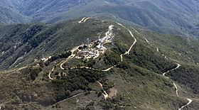
Trabuco Peak is a 4,607-foot (1,404 m) summit in the Santa Ana Mountains on the border of Orange and Riverside Counties, California, about halfway between Rancho Santa Margarita and Lake Elsinore. The mountain sits on the divide between Trabuco Creek (Trabuco Canyon) on the west and the Temescal Creek valley on the east. Situated in the Cleveland National Forest, it is the highest summit in the Santa Anas south of Santiago Peak.
Map of Trabuco Peak, California 92530, USA
The main trails providing access to the peak, the West Horsethief and Holy Jim trails, both begin at the bottom of Trabuco Canyon. The Main Divide Road, a fire road, also passes close to the peak.
References
Trabuco Peak Wikipedia(Text) CC BY-SA