
Topo map USGS Alberhill Elevation 1,376 m | Easiest route Hike Prominence 186 m | |
 | ||
Similar Trabuco Peak, Santiago Peak, Modjeska Peak, Elsinore Peak, San Mateo Peak | ||
The anti drought in southern california 2017 los pinos peak and saddleback mountain
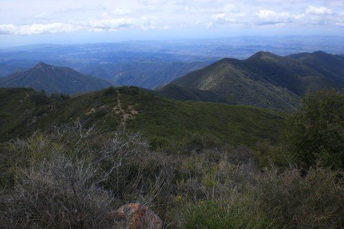
Los Pinos Peak is a 4,455-foot (1,358 m) summit in the Santa Ana Mountains in Orange County, California, about 8 miles (13 km) east of Rancho Santa Margarita. Los Pinos is the southernmost peak above 4,000 feet (1,200 m) in the Santa Anas, and provides extensive views south towards San Diego and the Pacific Ocean as well as views (on clear days) of the San Jacinto Mountains and San Bernardino Mountains in the east. The summit rises rather prominently above the main crest of the Santa Anas and is conspicuously visible from much of southern Orange County, although its actual topographic prominence is only about 610 feet (186 m).
Contents
- The anti drought in southern california 2017 los pinos peak and saddleback mountain
- Map of Los Pinos Peak California USA
- Los pinos peak
- References
Map of Los Pinos Peak, California, USA
The peak is situated in the Cleveland National Forest and is accessible by the Main Divide Road (a fire road); the Trabuco Canyon Trail, which begins near Trabuco Creek, and the Los Pinos Peak Trail, which begins in Hot Springs Canyon (near San Juan Canyon, San Juan Creek and the Ortega Highway (State Route 74).