
- summer (DST) CEST (UTC+2) | Area 7.787 km² | |
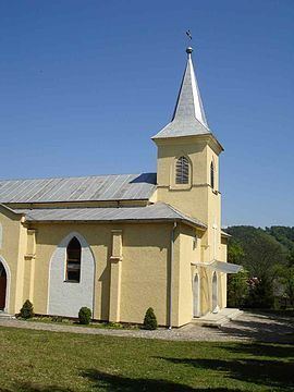 | ||
Topoľovka is a village and municipality in Humenné District in the Prešov Region of north-east Slovakia.
Contents
Map of 067 45 Topo%C4%BEovka, Slovakia
History
In historical records the village was first mentioned in 1479.
Geography
The municipality lies at an altitude of 157 metres (515 feet) and covers an area of 7.777 square kilometres (3.003 square miles). It has a population of about 825 people.
Twin towns — Sister cities
Topoľovka is twinned with:
References
Topoľovka Wikipedia(Text) CC BY-SA