
Population 12,871 (2011 census) Postcode(s) 3142 State electorate(s) MalvernPrahran Postal code 3142 | Established 1850s Area 4.3 km² Designer Ernest Fooks | |
 | ||
Location 5 km (3 mi) from Melbourne | ||
Toorak is an affluent inner suburb of Melbourne, Victoria, Australia, 5 km south-east from Melbourne's Central Business District. Its local government area is the City of Stonnington. At the 2011 census, Toorak had a population of 12,871.
Contents
- Map of Toorak VIC 3142 Australia
- Toponymy
- Toorak House
- 1880s land boom
- 1890s depression
- Post war era
- Contemporary Toorak
- Demographics
- Housing
- Politics
- Toorak Village
- Places of worship
- Schools
- Sport
- Transport
- Celebrities philanthropists cultural figures
- Politicians
- Businesspeople
- Sportspeople
- References
Map of Toorak VIC 3142, Australia
The name Toorak has become synonymous with wealth and privilege, the suburb long having the reputation of being Melbourne's most elite, and ranking among the most prestigious in Australia. It has the highest average property values in Melbourne, and is one of the most expensive suburbs in Australia. It is also listed as the "highest money-earning suburb" in the country.
Located on a rise on the south side (or left bank) of a bend in the Yarra River, Toorak is bordered by South Yarra, at Williams Road on the west, Malvern, at Glenferrie Road on the east, Prahran and Armadale, at Malvern Road to the south and the suburbs of Richmond, Burnley and Hawthorn on the north side of the river. The suburb's main street is considered to be Toorak Road, in which the commercial area of Toorak Village is located.
Toorak is named after Toorak House, the 1849-built residence of James Jackson, a merchant.
Toponymy
Toorak was named after Toorak House, an Italianate residence built by James Jackson, a merchant, in 1849. The name of the house may have originated from Woiwurrung language, with words of similar pronunciation meaning black crow or reedy swamp.
Toorak House
From 1854 Toorak House served as the residence of the first Governor of Victoria, Captain Sir Charles Hotham KCB RN and his successors, until the completion of the present Government House (1876) in the Kings Domain.
Toorak Post Office opened around June 1858.
1880s land boom
During the land boom of the 1880s, many large and elaborate mansions were erected in Toorak, often in the Italianate style. Following East Melbourne and then St Kilda, Toorak, along with Brighton, became the new favored location for the wealthy.
1890s depression
The suburb was hit particularly hard by the 1890s economic depression and many wealthy landowners declared bankruptcy and were forced to sell. Nonetheless, the suburb remained and is still Melbourne's home of "old money". In the 1920s, a favored style was Tudor revival.
Post-war era
In the period of post-World War II prosperity, rising standards of living and land values caused Toorak to become highly sought after by a new generation of the wealthy, thought by some to be social climbers and Nouveau riche. For some of these people, the focus was simply to have the postcode of Toorak, which was SE 2 and now 3142. As a result, many of the larger mansions were demolished and large holdings were subdivided to make way for flats, townhouses and apartments.
In the 1980s, larger houses in Neo-Georgian and Neo-Classical styles began to appear.
Contemporary Toorak
While large mansions have survived in neighbouring Hawthorn, Kew and Armadale, only a few of the original 19th-century mansions in Toorak remain, due in part to the high land value. Two of the most notable are Illawarra House, which was acquired by the National Trust; and Coonac, the most expensive house in Melbourne. In Toorak, some of the old property names live on as street names or the names of blocks of flats, carved out of or built on their sites.
Demographics
A study by the Department of Primary Industries revealed the following facts about Toorak:
Housing
Toorak has an unusual mix of high, low and medium-density housing, due to intense subdivision of larger lots in the 1880s, 1920s and 1960s. The predominant housing in Toorak (42.1%) is apartments, particularly walk-up flats.
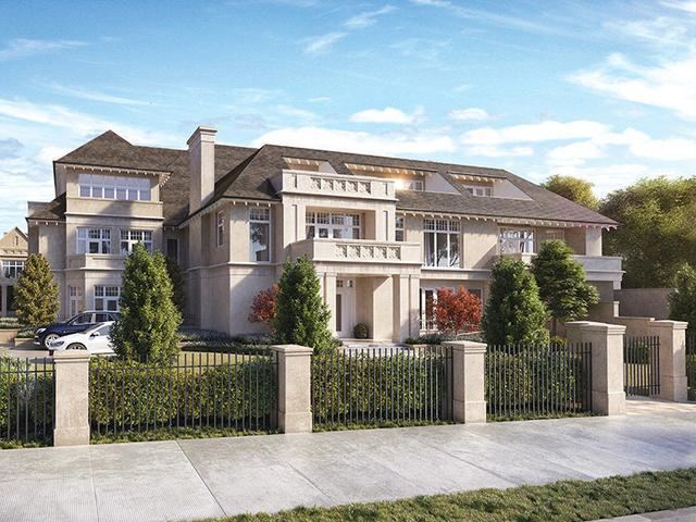
Single-family detached homes are also prevalent (29.6%). Some of these homes are in the form of traditional mansions or newer large residences on significant-sized estates, owned by Melbourne's wealthy and social elite. The architectural style of the mansions is predominantly Italianate and colonial. The premier residential streets of Toorak are generally considered by local real estate agents to be St. George's Road, Lansell Road, Hopetoun Road, Albany Road and Clendon Road. It is not unusual for Toorak houses to have extensive facilities, such as swimming pools and tennis courts behind solid gates and high walls to preserve the privacy of the residents.
There are also extant stands of attached housing (13.5%), including terraces, which were traditionally fashionable with the middle class and later gentrified.
Politics
Toorak falls within the federal electorate of Higgins. The seat of Higgins was created in 1949 and held by Harold Holt CH 1949–1967, Sir John Gorton PC GCMG AC CH 1968–1975, Roger Shipton OAM 1975–1990, Peter Costello AC 1990–2009 and Kelly O'Dwyer since 2009 (all on behalf of the Liberal Party of Australia). At state level, it mostly falls within the electorate of Malvern (currently held by the Liberals' Michael O'Brien), with the western part of the suburb falling within the electorate of Prahran (currently held by Sam Hibbins on behalf the Australian Greens). At local council level, Toorak falls within the City of Stonnington.
Typically for a wealthy inner-eastern suburb of Melbourne, Toorak is solidly Liberal-voting.
Toorak Village
The Toorak Village is a strip of shops and cafes, located centrally in Toorak Road.
Places of worship
The Wesleyan Church (1877), formerly on the corner of Toorak and Williams Roads, was illegally demolished in 1990 by developers and later replaced by a block of flats.
Schools
Schools in Toorak include St Catherine's School, Loreto Mandeville Hall, St Kevin's College, Glamorgan (now Toorak Campus, the junior school of Geelong Grammar School) and Toorak Central School (1890).
Sport
The Royal South Yarra Lawn Tennis Club is located in Toorak.
Transport
The most popular form of transport in Toorak is the automobile. CityLink runs along north eastern Toorak, though there are no interchanges within the suburb, although there is access to the freeway via MacRobertson Bridge and interchanges at Burnley. Main arterials running north-south are Williams Road (at the eastern boundary), Grange Road, Orrong Road, St Georges Road and Kooyong Road. The east-west arterials include Alexandra Avenue (at the northern boundary), Toorak Road (which runs midway through the suburb) and Malvern Road (at the southern boundary). Alexandra Avenue becomes St Georges Road and both along with Grange Road feed onto the MacRobertson Bridge, Toorak's main river crossing. Toorak's road planning is an example of street hierarchy. As a result, there are numerous quiet pedestrian streets. However, traffic congestion is an increasing problem along Toorak Road and Williams Roads. There is limited street parking along the main roads with just a couple of multi-storey car parks and parking lots within proximity of the main Toorak Road shopping strip. There are no level crossings in Toorak. There is a popular culture perception of Sport utility vehicle as status symbol (controversial for their luxury use, rather than for their off-road abilities) and this has been associated with the suburb of Toorak, such that in popular Australian culture, terms such as Toorak tractor, Toorak taxi, Toorak tank, or Toorak truck have become well established in Australian slang as pejoratives. An example of this was an episode of the popular program Top Gear Australia, aired on SBS TV, in which the presenters, tongue-in-cheek, drove a $200,000 tractor along Toorak Road.
Toorak's only railway station is Heyington, on the Glen Waverley line, which crosses the Yarra from Richmond on the Heyington Railway Bridge, to the suburb's north. Despite its name, Toorak railway station is located in Armadale. The Pakenham, Frankston and Cranbourne railway line group to which this station belongs runs close to Toorak's southern boundary. Other nearby stations include Hawksburn, in South Yarra and Kooyong, in Kooyong.
Trams have run down Toorak Road since 1888. Melbourne tram route 8 runs along Toorak Road to Glenferrie Road, at the suburb's eastern boundary. Melbourne tram route 72 runs along Malvern Road, the suburb's southern boundary.
Cycling facilities are poor, with few marked on road lanes. MacRobertson Bridge and Gardiners Creek pedestrian bridge, however, the bridge provides pedestrians access to the Main Yarra Trail and shared bicycle and pedestrian paths in nearby Burnley. Pedestrians are serviced by an extensive network of footpaths and pedestrian crossings.