
Airport type Public 15/33 7,161 2,183 Asphalt Code TPH Phone +1 775-482-3626 | Elevation AMSL 5,430 ft / 1,655 m 7,161 2,183 11/29 6,196 Elevation 1,654 m | |
 | ||
Address 1 Airport Rd, Tonopah, NV 89049, USA | ||
Tonopah airport structures from world war 2
Tonopah Airport (IATA: TPH, ICAO: KTPH, FAA LID: TPH) is a county owned, public use airport located seven nautical miles (13 km) east of the central business district of Tonopah, in Nye County, Nevada, United States.
Contents
- Tonopah airport structures from world war 2
- 08 04 2015 bocc tonopah airport
- Facilities and aircraft
- References
08 04 2015 bocc tonopah airport
Facilities and aircraft
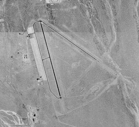
Tonopah Airport covers an area of 3,820 acres (1,550 ha) at an elevation of 5,430 feet (1,655 m) above mean sea level. It has two asphalt paved runways: 15/33 is 7,161 by 80 feet (2,183 x 24 m) and 11/29 is 6,196 by 50 feet (1,889 x 15 m).
For the 12-month period ending November 30, 2009, the airport had 12,727 aircraft operations, an average of 34 per day: 74% general aviation, 25% air taxi, and 2% military. At that time six aircraft were based here: 5 single-engine and 1 helicopter.
References
Tonopah Airport Wikipedia(Text) CC BY-SA