
Elevation 3,595 m Listing Ultra-prominent peak | Last eruption Unknown Prominence 1,946 m | |
 | ||
Similar Mount Takahe, Mount Murphy, Mount Siple, Mount Andrus, Mount Moulton | ||
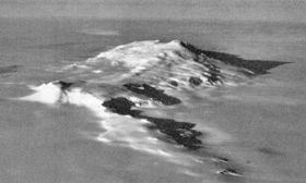
Toney Mountain is an elongated snow-covered shield volcano, 60 km (38 mi) long and rising to 3,595 m in Richmond Peak, located 56 km (35 mi) SW of Kohler Range in Marie Byrd Land, Antarctica. A 3 km-wide summit caldera tops the volcano and a sample from there yielded a potassium-argon date of 500,000 years ago. Holocene eruptions may have also occurred at Toney Mountain as indicated by 30 kyr ash layers in ice cores from Byrd Station.
Map of Toney Mountain, Antarctica
Toney Mountain was probably among those viewed from a distance by Admiral Byrd and others of the USAS in plane flights from the ship Bear in February 1940. It was mapped in December 1957 by the oversnow traverse party from Byrd Station to the Sentinel Range, 1957–58, led by C.R. Bentley who proposed the name. Named after George R. Toney, scientific leader at Byrd Station in 1957, a participant in several Antarctic and Arctic operations, serving in both field and administrative capacities.