
Elevation 3,078 m | ||
 | ||
Mountain type Shield volcano (extinct) Similar | ||
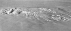
Mount Moulton is a broad, ice-covered shield volcano standing 16 km (10 mi) E of Mount Berlin in the Flood Range, Marie Byrd Land, Antarctica.
Map of Mount Moulton, Antarctica
Discovered on aerial flights by the United States Antarctic Service in 1940, and named for Richard S. Moulton, chief dog driver at West Base and a member of the survey party which sledged to the western end of the Flood Range in December 1940.
On the northern slopes of Mount Moulton, there are steep icefalls, called the Moulton Icefalls.
The Prahl Crags are located on the southern slopes of Mount Moulton.
References
Mount Moulton Wikipedia(Text) CC BY-SA