
Population 2,426 (2011 census) Postcode(s) 4882 Mean max temp Mean min temp Elevation 760 m Postal code 4882 | Established 1885 State electorate(s) Dalrymple Mean min temp Annual rainfall Founded 1885 Local time Sunday 7:26 PM | |
 | ||
Weather 22°C, Wind SE at 14 km/h, 78% Humidity | ||
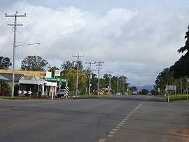
Tolga is a town and locality on the Atherton Tableland in the Tablelands Region in Far North Queensland, Australia. It is the centre of the region's peanut industry. In the 2011 census, Tolga had a population of 2,426 people.
Contents
Map of Tolga QLD 4882, Australia
History
The name Tolga means red mud in the local Aboriginal language. The town was originally called Martintown, and grew out of a Cobb and Co staging post at Rocky Creek.
At the 2006 census, Tolga had a population of 843.
Tolga Markets
Tolga Markets are held at the Tolga Racecourse from 7am to 12pm on the first Sunday of each month. Local produce, hand crafted items, clothing, tools and food are commonly found for sale. It is considered the second most popular market held on the Atherton Tableland, only slightly smaller than the Yungaburra Markets.
The Tolga Scrub
The Tolga Scrub on the southern side of town is one of the last remaining areas of Mabi rainforest on the Atherton Tableland. It is the most drought resistant type of rainforest in Australia. The Tolga Scrub is 2 kilometres (1.2 mi) long and 100 metres wide.
Heritage listings
Tolga has a number of heritage-listed sites, including: