
Population 7,287 (2011 census) State electorate(s) Dalrymple Mean max temp Mean min temp Postal code 4883 | Postcode(s) 4883 Elevation 700 m | |
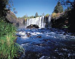 | ||
LGA(s) Tablelands Regional Council Weather 26°C, Wind E at 23 km/h, 64% Humidity Points of interest The Crystal Caves, Hou Wang Chinese Temple a, Atherton Forest Mountain, Hou Wang Temple, Hallorans Hill Conserva | ||
Atherton is a town and locality on the Atherton Tablelands within the Tablelands Region, Far North Queensland, Australia. At the 2011 census, Atherton had a population of 7,287.
Contents
- Map of Atherton QLD 4883 Australia
- History
- Heritage listings
- Climate
- Transport
- Economy
- Culture
- Education
- Health
- Notable people
- References
Map of Atherton QLD 4883, Australia
History
The town was named after John Atherton, a pioneer pastoralist who settled at Mareeba (then known as Emerald End) in 1875. The area was formerly known as Priors Pocket or Priors Creek.
Atherton Post Office opened by 1903 (a receiving office had been open since 1889).
The Atherton War Memorial commemorates local residents who died in World War I. It was dedicated on 1 May 1924 by the Tinaroo Shire chairman, Frederick Grau. It is the only war memorial in Queensland of a digger in an animated pose.
The Atherton Courthouse was used as a wartime hospital for officers during World War II and has air raid bunkers beneath the building.
Heritage listings
Atherton has a number of heritage-listed sites, including:
Climate
Atherton has a humid subtropical climate that differs from the surrounding tropical savannah climate due to the town's elevation high on the Atherton Plateau. Temperature extremes have ranged from 36.7 °C (98.1 °F) to –0.6 °C (30.9 °F). The average annual rainfall is 1,379.8 mm (54.3 in)
Transport
Atherton is joined by the Gillies Highway to Yungaburra, the Kennedy Highway north to Mareeba and south to Ravenshoe and Mount Garnet, the Malanda Road to Malanda and the Herberton Road to Herberton.
Trans North offers a number of return services during a seven-day week between Atherton, Tolga, Walkamin, Mareeba, Kuranda, and Cairns including drop-offs to airport, railway station, hospitals and bus depots. There are connections available between Ravenshoe and Herberton and along the Wheelbarrow Way to Chillagoe. There is an Atherton taxi service.
Economy
The land around Atherton is used to grow a variety of crops, including sugar cane, peanuts, mangoes, maize (corn), potatoes, avocados and macadamia nuts. Dairy and beef cattle are also reared in the area.
Culture
Each year towards the end of August, Atherton celebrates the Maize festival, which features a parade with decorated floats, the Maize Queen pageant, children's amusement rides and activities including tug of war and wood chopping. There are also shop window displays and artwork competitions, as well as a prize given to the best float.
The annual Atherton Agricultural Show is held in the second week of July at Atherton Show grounds including Heritage Listed Merriland Hall. The 'Atherton Show' is run by an army of volunteers of the (not-for-profit) Atherton Tableland Agricultural Society. Since 1904 the show brings together the values and aspirations of our community. It is a celebration of achievements ranging from the beauty of a delicate piece of embroidery to excellence in cattle breeding. There is also of course the fun of the rides and games in sideshow alley!
Education
Atherton has two primary schools, one secondary school, one independent Prep - Grade 12 school and a technical and further education (TAFE) campus. There are also two day care centres in the town.
Health
Atherton Hospital is in the Tablelands Health District. It hospital provides obstetric, medical, surgical, operating theatre, accident and emergency services.