
References NVE Shore length 185.5 km | Surface area 30.77 km (11.88 sq mi) Area 30.77 km² | |
 | ||
Max. depth 147 m (482 ft) (Rørholtfjorden) Surface elevation 60.35–55.75 m (198.0–182.9 ft), regulated Reference Norwegian Water Resources and Energy Directorate | ||
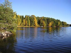
Toke is a lake in Drangedal municipality in Telemark, Norway, consisting of Upper and Lower Toke, which is connected via "Straumen" - "the stream". At the north end of Upper Toke is the town center Prestestranda. In the south, Lower Toke reaches into Bamble (Rørholtfjorden) and into Kragerø, where its outlet is in Lundereidelva at the Dalfoss hydroelectric plant. The lake, with its inflow, constitutes the majority of the Kragerø watershed.
Contents
Map of Toke, Norway
With a surface of about 19 square miles (49 km2) and a drainage basin of 770 square miles (2,000 km2), Toke is a substantial body of water in Telemark. The approximately 115 mile (185 km)-long shoreline, a large part of which consists of an old lakebed with deposits of silt, is strongly exposed to erosion because of development for power production. With its long shoreline and innumerable larger and smaller islands and narrow bays, Toke is a popular destination for boaters and sportsfishermen. Trout, Arctic char, whitefish, and perch are all found in the lake.
HistoryEdit
After the last Ice Age, about 9,500 years ago, the sea along the coast of Telemark was about 330 feet (100m) higher than today. Where Toke is currently, Drangedalsfjorden reached about 27 miles (60 km) onto land from Kragerø, through Drangedal, and up to Bø in Tørdal. The land rose quickly after the weight of the ice had gone. After about 1,000 years Toke became a lake, as it is known today. At the bottom of Rørholtfjorden, about 295 feet (90m) under the surface of the sea, a 32–40 foot (10-12m) layer of saltwater still exists from that time.
Since the arrival of man in the area about 9,000 years ago, Toke has served as a main artery between the sea and the inland. Signs from the Stone Age are found spread along the banks and on the islands of the lake. Cairns from the Bronze Age and Iron Ages are a common sight along the water's edge.
Boat TradeEdit
In 1864, a canal was made in "Straumen" between Upper and Lower Toke to make trade with larger vessels possible, and to make the transport of timber easier. Steamboat traffic started the same year, with DS "Tokedølen" which serviced the Prestestranda-Merkebekk area. In the fall of 1888, the more luxurious DS "Turist" came along with the same traffic. The owner of this boat, Halvor H. Strømme, had plans to build a canal in the area from Merkebekk down to the sea, but nothing came of it.
Trains and buses overtook most transportation then, and "Tokedølen" ran out of steady traffic around 1923. "Turist" kept going until 1929, when transport was taken care of by tugboats and barges.
Car traffic to Grenland was dependent on ferry transport across Lower Toke from Vefall to Kjenndalen, over the Vefall sound. This area was served by the ferry captain Karl Straume, first with barges of increasing size, and later with self-built ferries. The last ferry, "Vefaldsund II", went out of service when RV356 was made. RV356, on the east side of Toke and across Straume bridge, opened for traffic on 15 December 1967. This was the last inland ferry in this kind of trade in Norway.
RegulationEdit
Around 1530, the water saw came to the area, and the use of saws and export of timber grew steadily. Every river which ran into Toke was dammed for saw operation and timber transport, as well as Toke's outlet to the Lundereid river down towards Kragerø, where more sawing occurred, making use of the water power before it ebbed out into the sea.
Kragerøvassdragets fellesfløtningsforening (English: Kragerø Watershed Logging Association) got the first rights to regulate and dam Toke (and Hoseidvann) in 1899. With the advent of electricity, the rights to dam Toke were given to Norsk Elektrokemisk Aktieselskap (Norwegian Electrochemical Corporation) in 1916. These rights were followed by more extensions and delays, before Toke was dammed around 1940 as it is seen today, from 185 to 200 feet (60.35-55.75m). On average, more than 8,400 gallons (32,000 liters) of water run out of Toke each second. On its path towards the sea the water is used for power production in five hydroelectric plants throughout the municipality of Kragerø.
Since the beginning, regulation has been the subject of repeated complaints from the landowners along Toke, including Drangedal municipality. They think that the rights are wrongly interpreted, and that the banks around Toke are washed out illegally each year.