
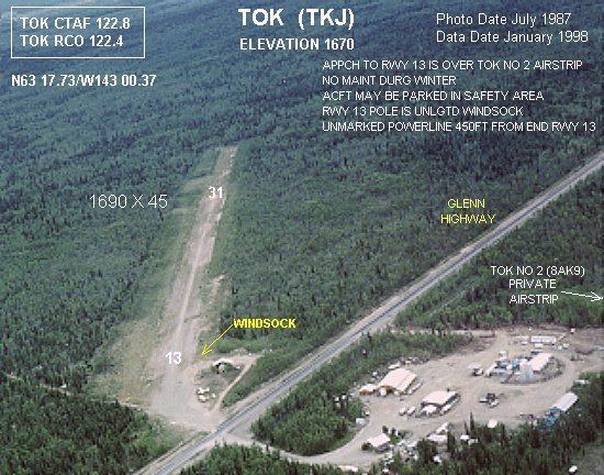
Airport type Public 13/31 1,690 515 Gravel/Turf Code TKJ | Elevation AMSL 1,670 ft / 509 m 1,690 515 Address Tok, AK 99780, USA Elevation 509 m | |
 | ||
Similar Tok Junction Airport - 6, Visitor Information Center, Interior Alaska Bus Line | ||
Tok Airport (IATA: TKJ, ICAO: PATJ, FAA LID: TKJ) was a state-owned public-use airport located two nautical miles (4 km) south of the central business district of Tok, in the Southeast Fairbanks Census Area of the U.S. state of Alaska.
Contents
Facilities and aircraft
Tok Airport has one runway designated 13/31 with a 1,690 by 45 ft (515 x 14 m) gravel and turf surface. For the 12-month period ending December 31, 2005, the airport had 600 aircraft operations, an average of 50 per month: 83% general aviation and 17% air taxi. At that time there were 17 aircraft based at this airport, all single-engine.
Other airports in Tok
References
Tok Airport Wikipedia(Text) CC BY-SA