
Country India Time zone IST (UTC+5:30) Population 3,675 (2011) | Founded by Lt. Col. Th. Lewin Local time Sunday 4:18 AM | |
 | ||
Named for A falls and rocky cliffs at Vantaikhawr Weather 23°C, Wind SE at 6 km/h, 86% Humidity Neighborhoods Zodin Veng, Kamalabagan, Serhuan | ||
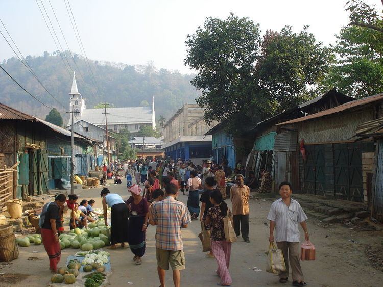
Tlabung is a census town in Lunglei district in the Indian state of Mizoram.
Contents
Map of Tlabung, Mizoram 796751
History
Tlabung previously known as Demagiri was an ancient center for Chakma people, the name was given after Devagiri (Chakma prince) who was later killed by Kooki head hunters. The township was first established and settled in November 1871 when the Superintendent of the Chittagong Hill Tracts Lt. Col. T.H. Lewin ordered his Assistant Mr. Crouch and 150 soldiers from the Frontier Battalion to build a fort at Tlabung which is to serve the Battalion Headquarters of the Southern Column of the Lushai Expedition to rescue a young girl named Mary Winchester from the Lushai Chief Bengkhuaia. It was made a part of the South Lushai Hills on April 1, 1898, while it was part of the Chittagong Hill Tracts earlier. It became a flourishing trade center during 1860-70 when Mizo in north and south had less knowledge of commerce. It was used as the main river port to import goods from what is now Bangladesh through Chittagong city. It had an old fort constructed during British time at the advice of Lt. Col. T.H. Lewin.
Demographics
As of 2001 India census, Tlabung had a population of 3,675. Males constitute 54% of the population and females 46%. Tlabung has an average literacy rate of 75%, higher than the national average of 59.5%: male literacy is 78%, and female literacy is 71%. In Tlabung, 17% of the population is under 6 years of age.
There were 4,754 people in Tlabung according to the preliminary census in 2005. Again the total population was divided into 2428 males and 2326 females. A total number of households recorded in the same year was 938.
Transport
Tlabung is 97 kilometers from Lunglei, the district headquarters and 332 kilometers from Aizawl, the state capital. The Khawthlangtuipui River flows through Tlabung, it is navigable up to Rangamati, Bangladesh but due to construction of Kaptai Dam, access to Port of Chittagong is not possible by boat but accessible by road.
Economy
A Border Trade facilitation center in Tlabung is in operation which helps with trade between Chittagong, Bangladesh and Tlabung, Mizoram. There are future plans to open the route from Tlabung to Chittagong port, it has been estimated that Mizoram can export raw and semi raw materials like bamboo while it can import iron, steel and crockeries.