
Last eruption Unknown First ascent 1 January 1 BC, 7 PM | Elevation 6,660 m Prominence 658 m | |
 | ||
Easiest route Hike, east side from El Arenal Similar Incahuasi, Falso Azufre, Cerro El Cóndor, Peinado, Monte Pissis | ||
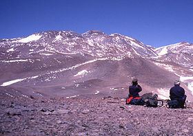
Cerro Tipas (also known as Cerro Cazadero or Cerro Walther Penck) is a massive complex volcano in the Andes, located in northwestern Argentina. It is just southwest of Ojos del Salado, the highest volcano in the world. Tipas itself is perhaps the third highest active volcano in the world, and it consists of stratovolcanoes, lava domes, and lava flows. Its summit is 6,668 metres (21,877 ft) above sea level and the complex covers a surface area of 25 square kilometres (9.7 sq mi). There are reports of fumarolic activity, and de Silva and Francis (1991) considered that the volcano was last active in the Holocene. The Tipas-Cerro Bayo complex was active 2.9-1.2 million years ago with dacites and rhyolites. Magma composition is typical for Andean stratovolcanoes. Tomographic studies of the underlying crust indicate a pattern of seismic attenuation beneath Tipas.