Kalpana Kalpana (Editor)

Timeline of the 2016 Pacific hurricane season

Updated on
Edit
Like
Comment
Share on FacebookTweet on TwitterShare on LinkedInShare on Reddit
Timeline of the 2016 Pacific hurricane season

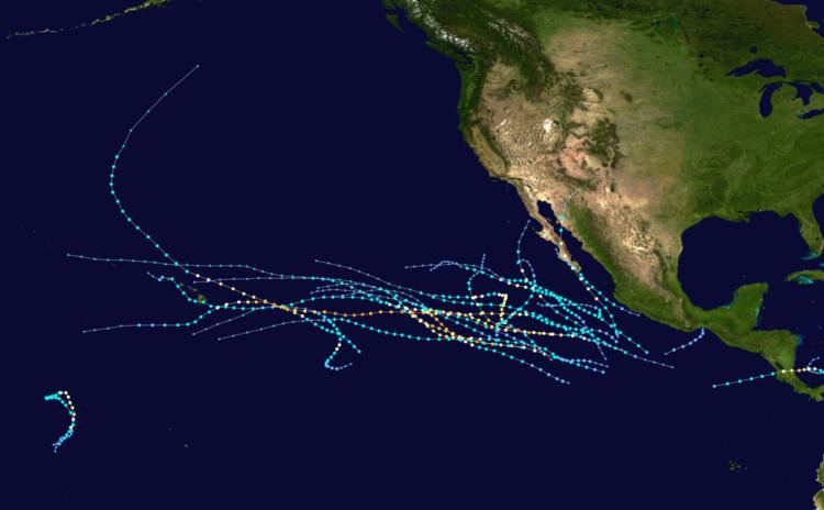
The 2016 Pacific hurricane season is an ongoing event in the annual cycle of tropical cyclone formation, in which tropical cyclones form in the eastern Pacific Ocean. The season officially started on May 15 in the eastern Pacific—east of 140°W—and on June 1 in the central Pacific—between the International Date Line and 140°W—and will last until November 30. These dates typically cover the period of each year when most tropical cyclones form in the eastern Pacific basin. However the first storm, Pali, formed 5 months before the official start of the season on January 7, which broke the record for having the earliest forming storm within the basin.

Contents

So far, seven tropical depressions developed, six of which became tropical storms. Four of the tropical storms reached hurricane strength, with two achieving major hurricane intensity. With the formation of Estelle, the season has had record amount of named storms in July, with six.

Four time zones are utilized in the basin: Central for storms east of 106°W, Mountain between 114.9°W and 106°W, Pacific between 140°W and 115°W, and Hawaii–Aleutian for storms between the International Date Line and 140°W. However, for convenience, all information is listed by Coordinated Universal Time (UTC) first with the respective local time included in parentheses. This timeline includes information that was not operationally released, meaning that data from post-storm reviews by the National Hurricane Center is included. This timeline documents tropical cyclone formations, strengthening, weakening, landfalls, extratropical transitions, and dissipations during the season.

January

January 1

  • 00:00 UTC (2:00 p.m. HST) at 2.2°N 176.4°W / 2.2; -176.4 (Tropical Depression Nine-C degenerates into a remnant area of low pressure) – 2015's Tropical Depression Nine-C degenerates into a remnant area of low pressure about 100 mi (160 km) north of Howland Island.
  • January 7
  • 15:00 UTC (5:00 a.m. HST) at 4.0°N 171.4°W / 4.0; -171.4 (Tropical Depression One-C forms) — Tropical Depression One-C develops from an area of thunderstorms and moisture from the previous storm 885 miles (1,425 km) south of Johnston Island.
  • 21:00 UTC (11:00 a.m. HST) at 4.0°N 171.4°W / 4.0; -171.4 (Tropical Depression One-C becomes Tropical Storm Pali) — With an increase of organization, Tropical Depression One-C strengthens into Tropical Storm Pali while located about 835 miles (1,345 km) south of Johnston Island.
  • January 12
  • 03:00 UTC (5:00 p.m. HST, January 11) at 8.1°N 171.9°W / 8.1; -171.9 (Tropical Storm Pali strengthens into a Category 1 hurricane) — Tropical Storm Pali strengthens into a Category 1 hurricane, which also became the earliest recorded hurricane within the basin while located about 615 miles (990 km) south-southwest of Johnston Island.
  • 21:00 UTC (11:00 a.m. HST) at 6.2°N 171.3°W / 6.2; -171.3 (Hurricane Pali strengthens into a Category 2 hurricane) — Hurricane Pali strengthens into a Category 2 hurricane about 735 miles (1,185 km) south of Johnston Island. It simultaneously achieves its peak strength with winds of 100 mph (155 km/h) and a pressure of 977 mbar (hPa; 28.85 inHg).
  • January 13
  • 09:00 UTC (11:00 p.m. HST, January 12) at 4.9°N 171.5°W / 4.9; -171.5 (Hurricane Pali weakens to a Category 1 hurricane) — Hurricane Pali weakens to a Category 1 hurricane roughly 825 miles (1,330 km) south of Johnston Island.
  • January 14
  • 03:00 UTC (5:00 p.m. HST, January 13) at 2.7°N 172.2°W / 2.7; -172.2 (Hurricane Pali weakens to a tropical storm) — Hurricane Pali weakens to a tropical storm about 330 miles (530 km) east-northeast of Howland Island.
  • 15:00 UTC (5:00 a.m. HST) at 2.5°N 173.0°W / 2.5; -173.0 (Tropical Storm Pali rapidly weakens to a tropical depression) — Tropical Storm Pali rapidly weakens to a tropical depression approximately 1,010 miles (1,625 km) south-southwest of Johnston Island.
  • January 15
  • 03:00 UTC (5:00 p.m. HST) at 1.7°N 173.2°W / 1.7; -173.2 (Tropical Depression Pali degenerates into a remnant low) — Tropical Depression Pali degenerates into a remnant low about 1,065 miles (1,715 km) south-southwest of Johnston Island.
  • May

    May 15
  • The 2016 Pacific hurricane season officially begins.
  • June

    June 6
  • 12:00 UTC (7:00 a.m. CDT) – Tropical Depression One-E develops from an area of low pressure about 180 miles (290 km) south-southwest of Puerto Escondido, Mexico.
  • 18:00 UTC (1:00 p.m. CDT) – Tropical Depression One-E attains its peak intensity with maximum sustained winds of 35 mph (55 km/h) and a minimum barometric pressure of 1006 mbar (hPa; 29.71 inHg) roughly 135 mi (215 km) south of Puerto Escondido, Mexico.
  • June 8
  • 00:00 UTC (7:00 p.m. CDT June 7) – Tropical Depression One-E degenerates into a remnant low approximately 40 mi (65 km) southeast of Salina Cruz, Mexico.
  • July

    July 2

  • 00:00 UTC (5:00 p.m. PDT, July 1) – Tropical Depression Two-E develops from an area of low pressure about 690 mi (1,110 km) southwest of the southern tip of the Baja California peninsula.
  • 18:00 UTC (2:00 p.m. PDT) – Tropical Depression Two-E intensifies into Tropical Storm Agatha roughly 800 mi (1,285 km) southwest of the Baja California peninsula.
  • July 3

  • 03:00 UTC (9:00 p.m. MDT July 2) at 11.1°N 108.3°W / 11.1; -108.3 (Tropical Depression Three-E forms) — Tropical Depression Three-E develops form about 605 mi (975 km) south-southwest of Manzanillo, Mexico.
  • 06:00 UTC (11:00 p.m. PDT, July 2) – Tropical Storm Agatha attains its peak intensity with maximum sustained winds of 50 mph (85 km/h) and a minimum barometric pressure of 1002 mbar (hPa; 29.59 inHg) about 895 mi (1,440 km) southwest of the Baja California peninsula.
  • 09:00 UTC (3:00 a.m. MDT) at 11.7°N 109.7°W / 11.7; -109.7 (Three-E becomes Blas) — Tropical Depression Three-E strengthens into Tropical Storm Blas roughly 620 mi (995 km) southwest of Manzanillo, Mexico.
  • July 4

  • 15:00 UTC (9:00 a.m. MDT) at 13.3°N 114.4°W / 13.3; -114.4 (Blas becomes a hurricane) — Tropical Storm Blas strengthens into a Category 1 hurricane about 725 mi (1,170 km) south-southwest of the southern tip of Baja California.
  • 18:00 UTC (11:00 a.m. PDT) – Tropical Storm Agatha weakens to a tropical depression about 1,250 mi (2,010 km) west-southwest of the Baja California peninsula.
  • July 5

  • 06:00 UTC (11:00 p.m. PDT, July 4) – Tropical Depression Agatha degenerates into a remnant area of low pressure roughly 1,375 mi (2,215 km) west-southwest of the Baja California peninsula.
  • 09:00 UTC (2:00 a.m. PDT) at 14.2°N 118.1°W / 14.2; -118.1 (Blas reaches Category 2 status) — Hurricane Blas strengthens into a Category 2 hurricane roughly 805 mi (1,295 km) southwest of the southern tip of Baja California.
  • 21:00 UTC (2:00 p.m. PDT) at 14.3°N 120.9°W / 14.3; -120.9 (Blas rapidly intensifies) — Hurricane Blas rapidly intensifies into a Category 3 hurricane roughly 930 mi (1,500 km) southwest of the southern tip of Baja California.
  • July 6

  • 03:00 UTC (8:00 p.m. PDT July 5) at 14.4°N 121.7°W / 14.4; -121.7 (Blas's peak intensity) – Hurricane Blas strengthens into a Category 4 hurricane, reaching its peak intensity with maximum sustained winds of 140 mph (220 km/h) and a barometric pressure of 947 mbar (hPa; 27.97 inHg) while situated approximately 970 mi (1,560 km) southwest of the southern tip of Baja California.
  • 09:00 UTC (2:00 a.m. PDT) at 14.7°N 122.7°W / 14.7; -122.7 (Blas weakens slightly) – Hurricane Blas weakens to a strong Category 3 hurricane roughly 1,010 mi (1,625 km) southwest of the southern tip of Baja California.
  • 18:00 UTC (12:00 p.m. MDT) – Tropical Depression Four-E develops from an area of low pressure about 545 mi (875 km) south-southwest of Manzanillo, Mexico.
  • July 8

  • 03:00 UTC (8:00 p.m. PDT July 7) at 16.9°N 128.6°W / 16.9; -128.6 (Blas weakens below major hurricane status) – Hurricane Blas weakens to a Category 2 hurricane roughly 1,280 mi (2,060 km) west-southwest of the southern tip of Baja California.
  • 12:00 UTC (6:00 a.m. PDT) – Tropical Depression Four-E intensifies into Tropical Storm Celia roughly 725 mi (1,165 km) south-southwest of the Baja California peninsula.
  • 21:00 UTC (2:00 p.m. PDT) at 18.5°N 130.5°W / 18.5; -130.5 (Blas weakens to a Category 1 hurricane) – Hurricane Blas weakens to a Category 1 hurricane roughly 1,365 mi (2,195 km) west of the southern tip of Baja California.
  • July 9
  • 09:00 UTC (2:00 a.m. PDT) at 19.5°N 131.7°W / 19.5; -131.7 (Blas rapidly weakens) – Hurricane Blas rapidly weakens to a tropical storm roughly 1,420 mi (2,290 km) west of the southern tip of Baja California.
  • July 10

  • 09:00 UTC (2:00 a.m. PDT) at 21.2°N 135.2°W / 21.2; -135.2 (Blas weakens to a tropical depression) — Tropical Storm Blas weakens to a tropical depression about 1,290 mi (2,075 km) east of Hilo, Hawaii.
  • 15:00 UTC (8:00 a.m. PDT) at 21.3°N 136.3°W / 21.3; -136.3 (Blas weakens into a remnant low) — Tropical Depression Blas degenerates into a remnant low approximately 1,220 mi (1,965 km) east of Hilo, Hawaii.
  • 18:00 UTC (11:00 a.m. PDT) – Tropical Storm Celia intensifies into a Category 1 hurricane approximately 955 mi (1,535 km) southwest of the Baja California peninsula.
  • July 11

  • 12:00 UTC (6:00 a.m. MDT) – Tropical Depression Five-E develops from an area of low pressure about 290 mi (465 km) south-southwest of Manzanillo, Mexico.
  • 18:00 UTC (11:00 a.m. PDT) – Hurricane Celia intensifies into a Category 2 hurricane and simultaneously attains its peak intensity with maximum sustained winds of 100 mph (160 km/h) and a minimum barometric pressure of 972 mbar (hPa; 28.71 inHg) about 1,170 mi (1,885 km) southwest of the Baja California peninsula.
  • July 12

  • 12:00 UTC (5:00 a.m. PDT) – Hurricane Celia weakens to a Category 1 hurricane roughly 1,265 mi (2,035 km) west-southwest of the Baja California peninsula.
  • 12:00 UTC (6:00 a.m. MDT) – Tropical Depression Five-E intensifies into Tropical Storm Darby about 335 mi (540 km) southwest of Manzanillo, Mexico.
  • July 13

  • 06:00 UTC (11:00 p.m. PDT, July 12) – Hurricane Celia weakens to a tropical storm approximately 1,570 mi (2,525 km) east-southeast of the Hawaiian Islands.
  • 18:00 UTC (12:00 p.m. MDT) – Tropical Storm Darby intensifies into a Category 1 hurricane about 545 mi (875 km) south-southwest of the Baja California peninsula.
  • July 15

  • 06:00 UTC (11:00 p.m. PDT, July 14) – Hurricane Darby intensifies into a Category 2 hurricane roughly 780 mi (1,255 km) southwest of the Baja California peninsula.
  • 12:00 UTC (6:00 am. MDT) – Tropical Depression Six-E develops from an area of low pressure about 365 mi (585 km) south-southwest of Manzanillo, Mexico.
  • July 16

  • 00:00 UTC (5:00 p.m. PDT, July 15) – Tropical Storm Celia degenerates into a remnant area of low pressure about 775 mi (1,245 km) east of the Hawaiian Islands.
  • 00:00 UTC (6:00 p.m. MDT, July 15) – Tropical Depression Six-E intensifies into Tropical Storm Estelle about 355 mi (570 km) southwest of Manzanillo, Mexico.
  • 12:00 UTC (5:00 a.m. PDT) – Hurricane Darby intensifies into a Category 3 hurricane roughly 945 mi (1,520 km) west-southwest of the Baja California peninsula.
  • 18:00 UTC (11:00 a.m. PDT) – Hurricane Darby attains its peak intensity with maximum sustained winds of 120 mph (195 km/h) and a minimum barometric pressure of 958 mbar (hPa; 28.29 inHg) approximately 995 mi (1,600 km) west-southwest of the Baja California peninsula.
  • July 17

  • 06:00 UTC (11:00 p.m. PDT, July 16) – Hurricane Darby weakens to a Category 2 hurricane about 1,100 mi (1,770 km) west-southwest of the Baja California peninsula.
  • 18:00 UTC (12:00 p.m. MDT) – Tropical Storm Estelle attains its peak intensity with maximum sustained winds of 70 mph (110 km/h) and a minimum barometric pressure of 990 mbar (hPa; 29.24 inHg) about 465 mi (750 km) south-southwest of the Baja California peninsula.
  • July 18

  • 00:00 UTC (5:00 p.m. PDT, July 17) – Hurricane Darby weakens to a Category 1 hurricane roughly 1,255 mi (2,020 km) west-southwest of the Baja California peninsula.
  • July 19

  • 06:00 UTC (11:00 p.m. PDT, July 18) – Hurricane Darby weakens to a tropical storm approximately 1,380 mi (2,220 km) east-southeast of the Hawaiian Islands.
  • July 21

  • 06:00 UTC (1:00 a.m. CDT) – Tropical Depression Seven-E develops from an area of low pressure about 290 mi (465 km) south-southeast of Manzanillo, Mexico.
  • 06:00 UTC (12:00 a.m. MDT) – Tropical Depression Eight-E develops from an area of low pressure approximately 805 mi (1,295 km) southwest of Manzanillo, Mexico.
  • 12:00 UTC (7:00 a.m. CDT) – Tropical Depression Seven-E intensifies into Tropical Storm Frank roughly 365 mi (585 km) south-southeast of Manzanillo, Mexico.
  • July 22

  • 00:00 UTC (5:00 p.m. PDT, July 21) – Tropical Storm Estelle degenerates into a remnant area of low pressure about 1,605 mi (2,585 km) east-southeast of the Hawaiian Islands.
  • 12:00 UTC (5:00 a.m. PDT) – Tropical Depression Eight-E intensifies into Tropical Storm Georgette roughly 855 mi (1,375 km) south-southwest of the Baja California peninsula.
  • July 24

  • 00:00 UTC (5:00 p.m. PDT, July 23) – Tropical Storm Georgette intensifies into a Category 1 hurricane about 1,025 mi (1,650 km) southwest of the Baja California peninsula.
  • 18:00 UTC (11:00 a.m. PDT) – Hurricane Georgette intensifies into a Category 2 hurricane about 1,105 mi (1,780 km) southwest of the Baja California peninsula.
  • July 25

  • 00:00 UTC (5:00 p.m. PDT, July 24) – Hurricane Georgette intensifies into a Category 3 hurricane about 1,130 mi (1,820 km) southwest of the Baja California peninsula.
  • 06:00 UTC (11:00 p.m. PDT, July 24) – Hurricane Georgette intensifies into a Category 4 hurricane and simultaneously attains its peak intensity with maximum sustained winds of 130 mph (210 km/h) and a minimum barometric pressure of 952 mbar (hPa; 28.12 inHg) about 1,150 mi (1,850 km) west-southwest of the Baja California peninsula.
  • 12:00 UTC (2:00 a.m. HST) – Tropical Storm Darby weakens to a tropical depression about 25 mi (35 km) north of Niʻihau, Hawaii.
  • 12:00 UTC (5:00 a.m. PDT) – Hurricane Georgette weakens to a Category 3 hurricane about 1,175 mi (1,890 km) west-southwest of the Baja California peninsula.
  • July 26

  • 00:00 UTC (2:00 p.m. HST, July 25) – Tropical Depression Darby degenerates into a remnant area of low pressure about 85 mi (140 km) northwest of Niʻihau, Hawaii.
  • 00:00 UTC (5:00 p.m. PDT, July 25) – Hurricane Georgette weakens to a Category 2 hurricane about 1,220 mi (1,965 km) west-southwest of the Baja California peninsula.
  • 06:00 UTC (11:00 p.m. PDT, July 25) – Hurricane Georgette weakens to a Category 1 hurricane about 1,235 mi (1,990 km) west-southwest of the Baja California peninsula.
  • 12:00 UTC (5:00 a.m. PDT) – Tropical Storm Frank intensifies into a Category 1 hurricane roughly 415 mi (670 km) west-southwest of the Baja California peninsula.
  • 18:00 UTC (11:00 a.m. PDT) – Hurricane Georgette weakens to a tropical storm about 1,240 mi (1,995 km) west-southwest of the Baja California peninsula.
  • July 27

  • 00:00 UTC (5:00 p.m. PDT, July 26) – Hurricane Frank attains its peak intensity with maximum sustained winds of 85 mph (140 km/h) and a minimum barometric pressure of 979 mbar (hPa; 28.91 inHg) approximately 530 mi (855 km) west-southwest of the Baja California peninsula.
  • 06:00 UTC (11:00 p.m. PDT, July 26) – Tropical Storm Georgette degenerates into a remnant area of low pressure about 1,245 mi (2,005 km) west-southwest of the Baja California peninsula.
  • 12:00 UTC (5:00 a.m. PDT) – Hurricane Frank weakens to a tropical storm about 655 mi (1,055 km) west of the Baja California peninsula.
  • July 28

  • 12:00 UTC (5:00 a.m. PDT) – Tropical Storm Frank degenerates into a remnant area of low pressure roughly 895 mi (1,440 km) west-northwest of the Baja California peninsula.
  • August

    August 3

  • 00:00 UTC (5:00 p.m. PDT, August 2) – Tropical Depression Ten-E develops from an area of low pressure about 750 mi (1,205 km) southwest of the Baja California peninsula.
  • 06:00 UTC (11:00 p.m. PDT, August 2) – Tropical Depression Ten-E intensifies into Tropical Storm Ivette roughly 820 mi (1,320 km) southwest of the Baja California peninsula.
  • August 5

  • 18:00 UTC (11:00 a.m. PDT) – Tropical Storm Ivette attains its peak intensity with maximum sustained winds of 60 mph (95 km/h) and a minimum barometric pressure of 1000 mbar (hPa; 29.53 inHg) approximately 1,485 mi (2,390 km) west-southwest of the Baja California peninsula.
  • August 7

  • 06:00 UTC (1:00 a.m. CDT) – Tropical Depression Eleven-E develops from an area of low pressure about 120 mi (195 km) south-southeast of Manzanillo, Mexico.
  • 12:00 UTC (7:00 a.m. CDT) – Tropical Depression Eleven-E intensifies into Tropical Storm Javier about 50 mi (85 km) south of Manzanillo, Mexico.
  • August 8

  • 06:00 UTC (8:00 p.m. HST, August 7) – Tropical Storm Ivette weakens to a tropical depression about 990 mi (1,595 km) east-southeast of the Hawaiian Islands.
  • 18:00 UTC (8:00 a.m. HST) – Tropical Depression Ivette degenerates to a remnant area of low pressure roughly 910 mi (1,465 km) east-southeast of the Hawaiian Islands.
  • 18:00 UTC (12:00 p.m. MDT) – Tropical Storm Javier attains its peak intensity with maximum sustained winds of 65 mph (100 km/h) and a minimum barometric pressure of 997 mbar (hPa; 29.44 inHg) about 65 mi (100 km) south-southeast of San José del Cabo, Mexico.
  • August 9

  • 03:30 UTC (9:30 p.m. MDT, August 8) – Tropical Storm Javier makes landfall near San José del Cabo, Mexico, with winds of 50 mph (85 km/h).
  • 12:00 UTC (6:00 a.m. MDT) – Tropical Storm Javier weakens to a tropical depression about 100 mi (160 km) northwest of San José del Cabo, Mexico.
  • 18:00 UTC (12:00 p.m. MDT) – Tropical Depression Javier degenerates to a remnant area of low pressure about 155 mi (250 km) northwest of San José del Cabo, Mexico.
  • August 18

  • 12:00 UTC (6:00 a.m. MDT) – Tropical Depression Twelve-E develops from an area of low pressure about 410 mi (660 km) south-southeast of the Baja California peninsula.
  • August 19

  • 06:00 UTC (12:00 a.m. MDT) – Tropical Depression Twelve-E intensifies into Tropical Storm Kay about 340 mi (545 km) south of the Baja California peninsula.
  • August 20

  • 12:00 UTC (6:00 a.m. MDT) – Tropical Storm Kay attains peak winds of 50 mph (85 km/h) about 260 mi (420 km) southwest of the Baja California peninsula.
  • August 21

  • 18:00 UTC (11:00 a.m. PDT) – Tropical Storm Kay attains a minimum barometric pressure of 1000 mbar (hPa; 29.53 inHg) about 340 mi (545 km) west-southwest of the Baja California peninsula.
  • August 23

  • 06:00 UTC (11:00 p.m. PDT, August 22) – Tropical Storm Kay weakens to a tropical depression about 580 mi (935 km) west of the Baja California peninsula.
  • 12:00 UTC (5:00 a.m. PDT) – Tropical Depression Kay degenerates to a remnant area of low pressure about 630 mi (1,015 km) west of the Baja California peninsula.
  • August 24

  • 06:00 UTC (12:00 a.m. MDT) – Tropical Depression Thirteen-E develops from an area of low pressure about 385 mi (620 km) south-southwest of Manzanillo, Mexico.
  • August 25

  • 06:00 UTC (12:00 a.m. MDT) – Tropical Depression Thirteen-E intensifies into Tropical Storm Lester about 485 mi (780 km) south of the Baja California peninsula.
  • August 26

  • 18:00 UTC (11:00 a.m. PDT) – Tropical Depression Fourteen-E develops from an area of low pressure about 1,295 mi (2,085 km) east-southeast of the Hawaiian Islands.
  • August 27

  • 00:00 UTC (5:00 p.m. PDT, August 26) – Tropical Storm Lester intensifies into a Category 1 hurricane about 530 mi (855 km) southwest of the Baja California peninsula.
  • 00:00 UTC (5:00 p.m. PDT, August 27) – Tropical Depression Fourteen-E intensifies into Tropical Storm Madeline about 1,250 mi (2,010 km) east-southeast of the Hawaiian Islands.
  • 12:00 UTC (5:00 a.m. PDT) – Hurricane Lester intensifies into a Category 2 hurricane about 615 mi (990 km) southwest of the Baja California peninsula.
  • August 28

  • 12:00 UTC (5:00 a.m. PDT) – Hurricane Lester weakens to a Category 1 hurricane about 905 mi (1,455 km) west-southwest of the Baja California peninsula.
  • August 29

  • 06:00 UTC (11:00 p.m. PDT, August 28) – Hurricane Lester re-intensifies into a Category 2 hurricane about 1,160 mi (1,865 km) west-southwest of the Baja California peninsula.
  • 12:00 UTC (5:00 a.m. PDT) – Hurricane Lester intensifies into a Category 3 hurricane about 1,255 mi (2,020 km) west-southwest of the Baja California peninsula.
  • 18:00 UTC (11:00 a.m. PDT) – Hurricane Lester intensifies into a Category 4 hurricane about 1,335 mi (2,180 km) west-southwest of the Baja California peninsula.
  • August 30

  • 06:00 UTC (11:00 p.m. PDT, August 29) – Hurricane Lester weakens to a Category 3 hurricane about 1,470 mi (2,365 km) southeast of the Hawaiian Islands.
  • August 31

  • 00:00 UTC (5:00 p.m. PDT, August 30) – Hurricane Lester re-intensifies into a Category 4 hurricane about 1,245 mi (2,005 km) southeast of the Hawaiian Islands.
  • 06:00 UTC (11:00 p.m. PDT, August 30) – Hurricane Lester attains its peak intensity with maximum sustained winds of 145 mph (235 km/h) and a minimum barometric pressure of 944 mbar (hPa; 27.88 inHg) about 1,175 mi (1,890 km) southeast of the Hawaiian Islands.
  • September

    September 4

  • 12:00 UTC (7:00 a.m. CDT) – Tropical Depression Fifteen-E develops from an area of low pressure about 255 mi (410 km) south of Manzanillo, Mexico.
  • 18:00 UTC (1:00 p.m. CDT) – Tropical Depression Fifteen-E intensifies into Tropical Storm Newton about 240 mi (385 km) south of Manzanillo, Mexico.
  • September 5

  • 18:00 UTC (12:00 p.m. MDT) – Tropical Storm Newton rapidly intensifies into a Category 1 hurricane about 130 mi (210 km) west-southwest of Cabo Corrientes, Mexico.
  • September 6

  • 06:00 UTC (12:00 a.m. MDT) – Hurricane Newton attains its peak intensity with maximum sustained winds of 90 mph (150 km/h) and a minimum barometric pressure of 977 mbar (hPa; 28.85 inHg) about 60 mi (95 km) south-southeast of Cabo San Lucas, Mexico.
  • 14:00 UTC (8:00 a.m. MDT) – Hurricane Newton makes its first landfall near El Cuñaño, Mexico, with winds of 85 mph (140 km/h).
  • September 7

  • 06:00 UTC (12:00 a.m. MDT) – Hurricane Newton weakens to a tropical storm about 60 mi (95 km) west of Guaymas, Mexico.
  • 08:30 UTC (2:30 a.m. MDT) – Tropical Storm Newton makes its second and final landfall about 15 mi (25 km) south of Bahía Kino, Mexico, with winds of 65 mph (100 km/h).
  • 18:00 UTC (12:00 p.m. MDT) – Tropical Storm Newton degenerates to a remnant area of low pressure about 40 mi (65 km) southwest of Nogales, Arizona.
  • September 11

  • 00:00 UTC (6:00 p.m. MDT, September 10) – Tropical Depression Sixteen-E develops from an area of low pressure about 805 mi (1,295 km) south-southwest of the Baja California peninsula.
  • 06:00 UTC (11:00 p.m. MDT, September 10) – Tropical Depression Sixteen-E intensifies into Tropical Storm Orlene about 685 mi (1,105 km) southwest of the Baja California peninsula.
  • September 12

  • 06:00 UTC (11:00 p.m. PDT, September 11) – Tropical Storm Orlene intensifies into a Category 1 hurricane about 705 mi (1,135 km) southwest of the Baja California peninsula.
  • 18:00 UTC (11:00 a.m. PDT) – Hurricane Orlene intensifies into a Category 2 hurricane and simultaneously attains its peak intensity with maximum sustained winds of 110 mph (175 km/h) and a minimum barometric pressure of 967 mbar (hPa; 28.56 inHg) about 690 mi (1,110 km) southwest of the Baja California peninsula.
  • September 13

  • 18:00 UTC (11:00 a.m. PDT) – Hurricane Orlene weakens to a Category 1 hurricane about 605 mi (975 km) west-southwest of the Baja California peninsula.
  • September 15

  • 00:00 UTC (5:00 p.m. PDT, September 14) – Hurricane Orlene weakens to a tropical storm about 665 mi (1,070 km) west-southwest of the Baja California peninsula.
  • 12:00 UTC (5:00 a.m. PDT) – Tropical Storm Orlene re-intensifies into a Category 1 hurricane about 765 mi (1,230 km) west-southwest of the Baja California peninsula.
  • September 16

  • 00:00 UTC (5:00 p.m. PDT, September 15) – Hurricane Orlene weakens to a tropical storm for a second time about 880 mi (1,415 km) west-southwest of the Baja California peninsula.
  • September 17

  • 00:00 UTC (5:00 p.m. PDT, September 16) – Tropical Storm Orlene degenerates to a remnant area of low pressure about 1,120 mi (1,800 km) west of the Baja California peninsula.
  • September 18

  • 00:00 UTC (6:00 p.m. MDT, September 17) – Tropical Depression Seventeen-E develops from an area of low pressure about 375 mi (605 km) west-southwest of Manzanillo, Mexico.
  • 06:00 UTC (12:00 a.m. MDT) – Tropical Depression Seventeen-E intensifies into Tropical Storm Paine about 410 mi (660 km) southwest of Manzanillo, Mexico.
  • September 19

  • 06:00 UTC (12:00 a.m. MDT) – Tropical Storm Paine intensifies into a Category 1 hurricane about 345 mi (555 km) southwest of the Baja California peninsula.
  • 18:00 UTC (11:00 a.m. PDT) – Hurricane Paine attains its peak intensity with maximum sustained winds of 90 mph (150 km/h) and a minimum barometric pressure of 979 mbar (hPa; 28.91 inHg) about 395 mi (635 km) west of the Baja California peninsula.
  • September 20

  • 06:00 UTC (11:00 p.m. PDT, September 19) – Hurricane Paine weakens to a tropical storm about 425 mi (685 km) west of La Paz, Mexico.
  • 18:00 UTC (11:00 a.m. PDT) – Tropical Storm Paine degenerates to a remnant area of low pressure about 145 mi (235 km) southwest of Punta Eugenia, Mexico.
  • November

    November 13

  • 06:00 UTC (12:00 a.m. MDT) – Tropical Storm Tina develops from an area of low pressure about 215 mi (345 km) southwest of Manzanillo, Mexico.
  • 12:00 UTC (6:00 a.m. MDT) – Tropical Storm Tina attains its peak intensity with maximum sustained winds of 40 mph (65 km/h) and a minimum barometric pressure of 1004 mbar (hPa; 29.65 inHg) about 210 mi (340 km) southwest of Manzanillo, Mexico.
  • November 14

  • 06:00 UTC (11:00 p.m. MST, November 13) – Tropical Storm Tina weakens to a tropical depression about 225 mi (360 km) west-southwest of Manzanillo, Mexico.
  • 12:00 UTC (5:00 a.m. MST) – Tropical Depression Tina degenerates to a remnant area of low pressure about 260 mi (420 km) west of Manzanillo, Mexico.
  • November 25

  • 03:30 UTC (10:30 p.m. CST) – Hurricane Otto weakens to a tropical storm as it exits the Atlantic basin and enters the East Pacific near the Gulf of Papagayo.
  • November 26

  • 12:00 UTC (7:00 a.m. CST) – Tropical Storm Otto weakens to a tropical depression about 420 mi (675 km) southwest of San Salvador, El Salvador.
  • 18:00 UTC (1:00 p.m. CST) – Tropical Depression Otto dissipates about 490 mi (790 km) south of Salina Cruz, Mexico.
  • November 30

  • The 2016 Pacific hurricane season officially ends.
  • References

    Timeline of the 2016 Pacific hurricane season Wikipedia