Puneet Varma (Editor)

Timeline of the 2014 Pacific hurricane season

Updated on
Edit
Like
Comment
Share on FacebookTweet on TwitterShare on LinkedInShare on Reddit
Timeline of the 2014 Pacific hurricane season

The 2014 Pacific hurricane season was an event in the annual cycle of tropical cyclone formation. It officially began on May 15 in the eastern Pacific—defined as the region east of 140°W—and began on June 1 in the central Pacific, defined as the region west of 140°W to the International Date Line; both ended on November 30.

Contents

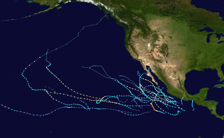
The season produced twenty-three tropical depressions. All but one further intensified into tropical storms and sixteen further intensified to become hurricanes, which broke the record holding the most number of hurricanes within the basin tied with the 1990 and 1992 seasons. The first named storm of the season, Amanda, developed on May 22 before intensifying into a hurricane on May 24. At 0300 UTC on May 25, it intensified into Category 3 on the Saffir–Simpson hurricane wind scale, becoming the second-earliest major hurricane on record, behind 2012's Hurricane Bud. At 1500 UTC, Amanda reached its peak intensity with winds of 155 mph (250 km/h), becoming the strongest May hurricane on record in the eastern Pacific. In mid-June, Hurricane Cristina intensified to become the earliest second major hurricane on the record in the East Pacific, beating the previous record set by Hurricane Darby in 2010. On August 24, Hurricane Marie became the first Category 5 Pacific hurricane since Hurricane Celia in 2010, and it was the sixth most intense Pacific hurricane on record in terms of minimum atmospheric pressure.

This timeline includes information that was not operationally released, meaning that data from post-storm reviews by the National Hurricane Center, such as a storm that was not operationally warned upon, has been included. The timeline also documents tropical cyclone formations, strengthening, weakening, landfalls, extratropical transitions, and dissipations during the season.

May

May 15

  • 0400 UTC (9:00 p.m. PDT May 14) – The 2014 Pacific hurricane season officially begins.
  • May 22

  • 1800 UTC (11:00 a.m. PDT) – Tropical Depression One-E develops from an area of low pressure about 635 mi (1,020 km) south-southwest of Manzanillo, Mexico.
  • May 23

  • 1800 UTC (11:00 a.m. PDT) – Tropical Depression One-E intensifies into Tropical Storm Amanda.
  • May 24

  • 1200 UTC (5:00 a.m. PDT) – Tropical Storm Amanda intensifies into a Category 1 hurricane on the Saffir–Simpson hurricane wind scale, becoming the first hurricane of the season.
  • May 25

  • 0000 UTC (5:00 p.m. PDT May 24) – Hurricane Amanda intensifies into a Category 2 hurricane.
  • 0600 UTC (11:00 p.m. PDT May 24) – Hurricane Amanda rapidly intensifies into a Category 4 hurricane.
  • 1200 UTC (5:00 a.m. PDT) – Hurricane Amanda attains its peak intensity with maximum sustained winds of 155 mph (250 km/h) and a minimum barometric pressure of 932 mb (hPa; 27.53 inHg), becoming the strongest May tropical cyclone on record in the eastern Pacific, roughly 770 mi (1,240 km) south of the southern tip of Baja California Sur, Mexico.
  • May 26

  • 1800 UTC (11:00 a.m. PDT) – Hurricane Amanda weakens to a Category 3 hurricane.
  • May 27

  • 1200 UTC (5:00 a.m. PDT) – Hurricane Amanda weakens to a Category 2 hurricane.
  • May 28

  • 0000 UTC (5:00 p.m. PDT May 27) – Hurricane Amanda weakens to a Category 1 hurricane.
  • 1200 UTC (5.00 a.m. PDT) – Hurricane Amanda weakens to a tropical storm.
  • May 29

  • 1200 UTC (5:00 a.m. PDT) – Tropical Storm Amanda weakens to a tropical depression roughly 460 mi (740 km) south of the southern tip of Baja California.
  • 1800 UTC (11:00 a.m. PDT) – Tropical Depression Amanda dissipates.
  • June

    June 2

  • 1800 UTC (11:00 a.m. PDT) – Tropical Depression Two-E develops from an area of low pressure roughly 195 mi (315 km) south of Tonalá, Mexico.
  • June 3

  • 1200 UTC (5:00 a.m. PDT) – Tropical Depression Two-E intensifies into Tropical Storm Boris about 85 mi (140 km) south-southwest of Tonalá, Mexico, attaining peak intensity with winds of 45 mph (75 km/h).
  • June 4

  • 0600 UTC (11:00 p.m. PDT June 3) – Tropical Storm Boris weakens to a tropical depression about 25 mi (35 km) southwest of Tonalá, Mexico.
  • 1800 UTC (11:00 a.m. PDT) – Tropical Depression Boris degenerates to a remnant area of low pressure and dissipates a short time later over the Gulf of Tehuantepec.
  • June 9

  • 1200 UTC (5:00 a.m. PDT) – Tropical Depression Three-E develops from a disturbance about 155 mi (250 km) southwest of Acapulco, Mexico.
  • June 10

  • 0600 UTC (11:00 p.m. PDT June 9) – Tropical Depression Three-E intensifies into Tropical Storm Cristina.
  • June 11

  • 0600 UTC (11:00 p.m. PDT June 10) – Tropical Storm Cristina intensifies into a Category 1 hurricane.
  • June 12

  • 0000 UTC (5:00 p.m. PDT June 11) – Hurricane Cristina intensifies into a Category 2 hurricane.
  • 0600 UTC (11:00 p.m. PDT June 11) – Hurricane Cristina rapidly intensifies into a Category 3 hurricane, becoming the earliest second major hurricane on record in the East Pacific.
  • 1200 UTC (5:00 a.m. PDT) – Hurricane Cristina rapidly intensifies into a Category 4 hurricane about 240 mi (390 km) southwest of Manzanillo, Mexico, attaining peak intensity with winds of 150 mph (240 km/h) and a minimum pressure of 935 mbar (27.61 inHg).
  • June 13

  • 0000 UTC (5:00 p.m. PDT June 12) – Hurricane Cristina weakens to a Category 3 hurricane.
  • 0600 UTC (11:00 p.m. PDT June 12) – Hurricane Cristina weakens to a Category 2 hurricane.
  • 1800 UTC (11:00 a.m. PDT) – Hurricane Cristina weakens to a Category 1 hurricane.
  • June 14

  • 1200 UTC (5:00 a.m. PDT) – Hurricane Cristina weakens to a tropical storm roughly.
  • June 15

  • 0600 UTC (11:00 p.m. PDT June 16) – Tropical Storm Cristina becomes a non-convective low roughly 265 mi (425 km) southwest of Cabo San Lucas, Mexico.
  • June 28

  • 1800 UTC (11:00 a.m. PDT) – Tropical Depression Four-E develops from an area of low pressure approximately 345 mi (555 km) south-southwest of Manzanillo, Mexico.
  • June 30

  • 0000 UTC (5:00 p.m. PDT June 29) – Tropical Depression Four-E intensifies into Tropical Storm Douglas.
  • 0600 UTC (11:00 p.m. PDT June 29) – Tropical Storm Elida develops from an area of low pressure about 175 mi (280 km) southeast of Manzanillo, Mexico.
  • July

    July 1

  • 1800 UTC (11:00 a.m. PDT) – Tropical Storm Douglas peaks in intensity with winds of 50 mph (85 km/h) about 460 mi (740 km) southwest of Cabo San Lucas, Mexico.
  • July 2

  • 0000 UTC (5:00 p.m. PDT July 1) – Tropical Storm Elida weakens to a tropical depression.
  • July 3

  • 0600 UTC (11:00 p.m. PDT July 2) – Tropical Depression Elida degenerates to a remnant area of low pressure south of Zihuatanejo, Mexico.
  • July 6

  • 0600 UTC (11:00 p.m. PDT July 5) – Tropical Storm Douglas degenerates into a remnant low.
  • July 7

  • 1200 UTC (5:00 a.m. PDT) – Tropical Depression Six develops from an area of low pressure about 1,095 mi (1,760 km) south-southwest of the southern tip of Baja California.
  • 1800 UTC (11:00 a.m. PDT) – Tropical Depression Six intensifies to Tropical Storm Fausto.
  • July 9

  • 0000 UTC (5:00 p.m. PDT July 8) – Tropical Storm Fausto weakens to a tropical depression.
  • 1200 UTC (5:00 a.m. PDT) – Tropical Depression Fausto dissipates.
  • July 17

  • 2100 UTC (11:00 a.m. HST) – Tropical Depression One-C develops from an area of low pressure about 1,070 mi (1,720 km) east-southeast of Hilo, Hawaii.
  • 2200 UTC (12:00 p.m. HST) – Tropical Depression One-C intensifies into Tropical Storm Wali about 1,060 mi (1,705 km) east-southeast of Hilo, Hawaii.
  • July 18

  • 2100 UTC (11:00 a.m. HST) – Tropical Storm Wali weakens to a tropical depression about 775 mi (1,245 km) east-southeast of Hilo, Hawaii.
  • July 19

  • 0300 UTC (5:00 p.m. HST July 18) – Tropical Depression Wali degenerates into a remnant area of low pressure about 715 mi (1,150 km) east-southeast of Hilo, Hawaii.
  • July 25

  • 0000 UTC (5:00 p.m. PDT July 24) – Tropical Depression Seven-E develops from a low pressure area approximately 1,695 mi (2,730 km) west-southwest of Cabo San Lucas, Mexico.
  • 0600 UTC (11:00 p.m. PDT July 24) – Tropical Depression Seven-E intensifies into Tropical Storm Genevieve.
  • July 26

  • 0600 UTC (11:00 p.m. PDT July 25) – Tropical Depression Eight-E develops from an area of low pressure roughly 405 mi (650 km) southwest of Zihuatanejo, Mexico.
  • 1200 UTC (5:00 a.m. PDT) – Tropical Storm Genevieve weakens to a tropical depression.
  • 1800 UTC (11:00 a.m. PDT) – Tropical Depression Eight-E strengthens to Tropical Storm Hernan approximately 345 mi (555 km) southwest of Manzanillo, Mexico.
  • July 27

  • 0600–1200 UTC (2:00–5:00 a.m. PDT) – Tropical Depression Genevieve crosses 140°W, leaving the jurisdiction of the National Hurricane Center and entering the area monitored by the Central Pacific Hurricane Center.
  • 1800 UTC (11:00 a.m. PDT) – Tropical Storm Hernan strengthens into a Category 1 hurricane about 335 mi (535 km) south-southwest of the southern tip of the Baja California peninsula.
  • July 28

  • 0000 UTC (2:00 p.m. HST July 27) – Tropical Depression Genevieve degenerates to a remnant low.
  • 0600 UTC (11:00 p.m. PDT July 27) – Hurricane Hernan weakens to a tropical storm.
  • July 29

  • 1200 UTC (5:00 a.m. PDT) – Tropical Storm Hernan degenerates into a post-tropical remnant low approximately 660 mi (1,065 km) west of the southern tip of the Baja California peninsula.
  • 1800 UTC (8:00 a.m. HST) – The remnants of Genevieve regenerate to a tropical depression.
  • July 31

  • 1200 UTC (5:00 a.m. PDT) – Tropical Depression Nine-E develops from an area of low pressure.
  • 1800 UTC (11:00 a.m. PDT) – Tropical Depression Nine-E intensifies into Tropical Storm Iselle.
  • August

    August 1

  • 0000 UTC (2:00 p.m. HST June 31) – Tropical Depression Genevieve degenerates to a disturbance southeast of the Hawaiian Islands.
  • August 2

  • 0000 UTC (5:00 p.m. PDT August 1) – Tropical Storm Iselle intensifies into a Category 1 hurricane.
  • 1200 UTC (2:00 a.m. HST) – The remnants of Genevieve regenerate to a tropical depression for a second time.
  • 1800 UTC (8:00 a.m. HST) – Tropical Depression Genevieve strengthens to tropical storm intensity for a second time.
  • 1800 UTC (11:00 a.m. PDT) – Hurricane Iselle intensifies into a Category 2 hurricane.
  • August 3

  • 0000 UTC (2:00 p.m. HST August 2) – Tropical Storm Genevieve weakens for a second time to a tropical depression.
  • 1200 UTC (5:00 a.m. PDT) – Hurricane Iselle intensifies into a Category 3 hurricane.
  • August 4

  • 0000 UTC (5:00 p.m. PDT August 3) – Tropical Depression Ten-E develops from a tropical disturbance about 785 mi (1,260 km) south-southwest of the southern tip of Baja California Sur, Mexico.
  • 0600 UTC (11:00 p.m. PDT August 3) – Tropical Depression Ten-E intensifies into Tropical Storm Julio.
  • 1200 UTC (5:00 a.m. PDT) – Hurricane Iselle intensifies into a Category 4 hurricane.
  • 1800 UTC (11:00 a.m. PDT) – Hurricane Iselle peaks in intensity with a minimum pressure of 947 millibars (27.96 inHg) and maximum sustained winds of 140 mph (220 km/h).
  • August 5

  • 0600 UTC (11:00 p.m. PDT August 4) – Hurricane Iselle weakens to a Category 3 hurricane.
  • 1800 UTC (8:00 a.m. HST) – Tropical Depression Genevieve intensifies into a tropical storm for a third time.
  • 1800 UTC (11:00 a.m. PDT) – Hurricane Iselle weakens to Category 2 intensity.
  • August 6

  • 0000 UTC (5:00 p.m. PDT August 5) – Hurricane Iselle crosses 140°W, leaving the National Hurricane Center's area of responsibility and entering the area monitored by the Central Pacific Hurricane Center.
  • 0600 UTC (11:00 p.m. PDT August 5) – Tropical Storm Julio strengthens into a Category 1 hurricane.
  • 1200 UTC (2:00 a.m. HST) – Tropical Storm Genevieve intensifies into a Category 1 hurricane.
  • August 7

  • 0000 UTC (2:00 p.m. HST August 6) – Hurricane Genevieve rapidly intensifies to a Category 3 hurricane.
  • 0600 UTC (8:00 p.m. HST August 6) – Hurricane Genevieve rapidly strengthens to Category 4 intensity as it crosses the International Date Line (180°), entering the western Pacific basin monitored by the Japan Meteorological Agency, and it is reclassified as Typhoon Genevieve.
  • 0600 UTC (11:00 p.m. PDT August 6) – Hurricane Julio attains Category 2 intensity.
  • 1200 UTC (2:00 a.m. HST) – Hurricane Iselle weakens to a Category 1 hurricane.
  • August 8

  • 0000 UTC (5:00 p.m. PDT August 7) – Hurricane Julio intensifies into a Category 3 hurricane, becoming the fourth major hurricane of the season.
  • 0600 UTC (8:00 p.m. HST August 7) – Hurricane Iselle weakens to a tropical storm.
  • 0600 UTC (11:00 p.m. PDT August 7) – Hurricane Julio attains its peak intensity with a minimum pressure of about 960 millibars (28.35 inHg) and maximum sustained winds of 120 mph (195 km/h).
  • 1200 UTC (2:00 p.m. HST) – Hurricane Julio weakens to Category 2 intensity.
  • 1230 UTC (2:30 a.m. HST) – Tropical Storm Iselle makes landfall along the Big Island's Kau Coast.
  • August 9

  • 0600 UTC (8:00 p.m. HST August 8) – Tropical Storm Iselle degenerates to a remnant area of low pressure.
  • August 10

  • 0000 UTC (2:00 p.m. HST August 9) – Hurricane Julio weakens to a Category 1 hurricane.
  • August 12

  • 0000 UTC (2:00 p.m. HST August 11) – Hurricane Julio weakens to a tropical storm.
  • August 13

  • 0000 UTC (2:00 p.m. HST August 12) – Tropical Storm Julio reintensifies to a Category 1 hurricane.
  • 0000 UTC (5:00 p.m. PDT August 12) – Tropical Depression Eleven-E develops from an area of low pressure approximately 290 mi (465 km) southwest of Manzanillo, Mexico.
  • 1200 UTC (5:00 a.m. PDT) – Tropical Depression Eleven-E intensifies into Tropical Storm Karina.
  • August 14

  • 0600 UTC (8:00 p.m. HST August 13) – Hurricane Julio weakens to a tropical storm for a second time.
  • 1800 UTC (11:00 a.m. PDT) – Tropical Storm Karina intensifies to a Category 1 hurricane.
  • August 15

  • 0000 UTC (5:00 p.m. PDT August 16) – Hurricane Karina weakens to a tropical storm.
  • 1200 UTC (2:00 a.m. HST) – Tropical Storm Julio weakens to a tropical depression.
  • 1800 UTC (8:00 a.m. HST) – Tropical Depression Julio degenerates to a remnant low.
  • August 17

  • 1200 UTC (5:00 a.m. PDT) – Tropical Depression Twelve-E develops from an area of low pressure approximately 575 mi (925 km) southwest of the southern tip of the Baja California peninsula.
  • August 18

  • 1800 UTC (11:00 a.m. PDT) – Tropical Depression Twelve-E intensifies to Tropical Storm Lowell.
  • August 21

  • 1200 UTC (5:00 a.m. PDT) – Tropical Storm Lowell intensifies to a Category 1 hurricane roughly 805 mi (1,295 km) west-southwest of the southern tip of Baja California.
  • August 22

  • 0000 UTC (5:00 p.m. PDT August 21) – Hurricane Lowell weakens to a tropical storm.
  • 0000 UTC (5:00 p.m. PDT August 21) – Tropical Depression Thirteen-E develops from an area of low pressure approximately 370 mi (595 km) south-southeast of Acapulco, Mexico.
  • 0600 UTC (11:00 p.m. PDT August 21) – Tropical Depression Thirteen-E intensifies to Tropical Storm Marie.
  • 1800 UTC (11:00 a.m. PDT) – Tropical Storm Karina reintensifies to a Category 1 hurricane.
  • August 23

  • 0600 UTC (11:00 p.m. PDT August 22) – Hurricane Karina peaks in intensity with a minimum pressure of 983 millibars (29.03 inHg) and maximum sustained winds of 85 mph (140 km/h).
  • 0600 UTC (11:00 p.m. PDT August 22) – Tropical Storm Marie intensifies to a Category 1 hurricane.
  • August 24

  • 0000 UTC (5:00 p.m. PDT August 23) – Tropical Storm Lowell weakens to a tropical depression.
  • 0000 UTC (5:00 p.m. PDT August 23) – Hurricane Marie intensifies to a Category 2 hurricane.
  • 0600 UTC (11:00 p.m. PDT August 23) – Hurricane Karina weakens to a tropical storm.
  • 0600 UTC (11:00 p.m. PDT August 23) – Hurricane Marie rapidly intensifies to a Category 4 hurricane.
  • 1200 UTC (5:00 a.m. PDT) – Tropical Depression Lowell degenerates to a remnant area of low pressure about 835 mi (1,435 km) west-southwest of Punta Eugenia, Mexico.
  • 1800 UTC (2:00 p.m. PDT) – Hurricane Marie intensifies to a Category 5 hurricane, the strongest storm of the season, about south-southwest of Cabo San Lucas and simultaneously peaks in intensity with maximum sustained winds of 160 mph (260 km/h) and a minimum atmospheric pressure of 918 millibars (27.1 inHg).
  • August 25

  • 0000 UTC (5:00 p.m. PDT August 24) – Hurricane Marie weakens to Category 4 hurricane.
  • 1200 UTC (5:00 a.m. PDT) – Tropical Storm Karina weakens to a tropical depression.
  • August 26

  • 0000 UTC (5:00 p.m. PDT August 25) – Hurricane Marie weakens to a Category 3 hurricane.
  • 0600 UTC (11:00 p.m. PDT August 25) – Hurricane Marie weakens to a Category 2 hurricane.
  • 1800 UTC (11:00 a.m. PDT) – Tropical Depression Karina degenerates into a remnant low.
  • August 27

  • 0000 UTC (5:00 p.m. PDT August 26) – Hurricane Marie weakens to a Category 1 hurricane.
  • 1800 UTC (11:00 a.m. PDT) – Hurricane Marie weakens to a tropical storm.
  • August 28

  • 1800 UTC (11:00 a.m. PDT) – Tropical Storm Marie degenerates to a remnant area of low pressure.
  • August 29

  • 0000 UTC (5:00 p.m. PDT August 28) – The remnant circulation of Lowell dissipates into a trough about 1,065 mi (1,715 km) northeast of the Hawaiian Islands.
  • September

    September 2

  • 1200 UTC (5:00 a.m. PDT) – The remnants of Marie dissipate.
  • 1500 UTC (8:00 a.m. PDT) – Tropical Storm Norbert develops from an area of low pressure about 180 mi (285 km) southwest of Manzanillo, Mexico and roughly 435 mi (695 km) south-southeast of the southern tip of Baja California.
  • September 4

  • 0000 UTC (5:00 p.m. PDT September 3) – Tropical Storm Norbert intensifies to a Category 1 hurricane roughly 215 mi (345 km) south of the southern tip of Baja California.
  • September 6

  • 0000 UTC (5:00 p.m. PDT September 5) – Hurricane Norbert attains Category 2 intensity approximately 60 mi (95 km) south-southwest of Cabo San Lazaro, Mexico and approximately 185 mi (300 km) west-northwest of Cabo San Lucas, Mexico.
  • September 7

  • 0600 UTC (11:00 p.m. PDT September 6) – Hurricane Norbert intensifies to a Category 3 hurricane roughly 55 mi (90 km) south-southwest of Cabo San Lazaro, Mexico and roughly 265 mi (425 km) south-southeast of Punta Eugenia, Mexico.
  • 2100 UTC (2:00 p.m. PDT) – Hurricane Norbert weakens to a Category 2 hurricane roughly 160 miles (260 km) west of Cabo San Lazaro, Mexico and about 175 miles (280 km) south of Punta Eugenia, Mexico.
  • September 7

  • 0300 UTC (8:00 p.m. PDT September 6) – Hurricane Norbert weakens to a Category 1 hurricane roughly 160 miles (260 km) south of Punta Eugenia, Mexico and about 205 miles (330 km) west-northwest of Cabo San Lazaro, Mexico.
  • 1500 UTC (8:00 a.m. PDT) – Hurricane Norbert weakens to a tropical storm about 170 miles (275 km) southwest of Punta Eugenia, Mexico.
  • September 8

  • 0900 UTC (2:00 a.m. PDT) – Tropical Storm Norbert becomes a post-tropical cyclone approximately 200 mi (320 km) west of Punta Eugenia, Mexico.
  • September 10

  • 0900 UTC (2:00 a.m. PDT) – Tropical Depression Fifteen-E develops from an area of low pressure roughly 245 mi (395 km) southwest of Acapulco, Mexico and approximately 250 mi (400 km) south of Lázaro Cárdenas, Mexico.
  • 1500 UTC (8:00 a.m. PDT) – Tropical Depression Fifteen-E intensifies to Tropical Storm Odile approximately 220 mi (350 km) south-southwest of Lázaro Cárdenas, Mexico.
  • September 11

  • 1530 UTC (8:30 a.m. PDT) – Tropical Depression Sixteen-E develops from an area of low pressure roughly 775 mi (1250 km) southwest of the southern tip of Baja California.
  • September 13

  • 0900 UTC (2:00 a.m. PDT) – Tropical Storm Odile intensifies to a Category 1 hurricane about 200 mi (320 km) south-southwest of Manzanillo, Mexico and about 275 mi (445 km) south of Cabo Corrientes, Mexico.
  • September 14

  • 0000 UTC (5:00 p.m. PDT September 13) – Hurricane Odile attains Category 2 intensity roughly 170 mi (275 km) southwest of Manzanillo, Mexico and approximately 450 mi (725 km) south-southeast of the southern tip of Baja California.
  • 0600 UTC (11:00 p.m. PDT September 13) – Hurricane Odile intensifies to a Category 3 hurricane about 175 mi (280 km) west-southwest of Manzanillo, Mexico and roughly 365 mi (590 km) south-southeast of the southern tip of Baja California.
  • 0900 UTC (2:00 a.m. PDT) – Hurricane Odile attains Category 4 intensity approximately 195 mi (315 km) west of Manzanillo, Mexico and roughly 310 mi (500 km) south-southeast of the southern tip of Baja California.
  • 2100 UTC (2:00 p.m. PDT) – Hurricane Odile weakens to a Category 3 hurricane roughly 330 mi (535 km) west-northwest of Manzanillo, Mexico and roughly 140 mi (225 km) south-southeast of the southern tip of Baja California.
  • September 15

  • 0300 UTC (8:00 p.m. PDT September 14) – Tropical Depression Sixteen-E dissipates about 480 mi (775 km) south-southwest of the southern tip of Baja California.
  • 0445 UTC (9:45 p.m. PDT September 14) – Hurricane Odile makes landfall near Cabo San Lucas, Mexico with an estimated intensity of 125 mph (205 km/h), tying Odile with 1967's Hurricane Olivia as the most powerful hurricane to make landfall in the Mexican state of Baja California Sur in the satellite era.
  • 1200 UTC (5:00 a.m. PDT) – Hurricane Odile weakens to a Category 2 hurricane approximately 40 mi (60 km) west of La Paz, Mexico and about 90 mi (145 km) east-southeast of Cabo San Lazaro, Mexico.
  • 1800 UTC (11:00 a.m. PDT) – Hurricane Odile weakens to a Category 1 hurricane about 45 mi (70 km) east-northeast of Cabo San Lazaro, Mexico and roughly 65 mi (100 km) south of Loreto, Mexico.
  • September 16

  • 0300 UTC (8:00 p.m. PDT September 15) – Hurricane Odile weakens to a tropical storm approximately 60 mi (95 km) northwest of Loreto, Mexico.
  • 0900 UTC (2:00 a.m. PDT) – Tropical Storm Polo develops from an area of low pressure roughly 360 mi (580 km) south-southeast of Acapulco, Mexico.
  • September 18

  • 0300 UTC (8:00 p.m. PDT September 17) – Tropical Storm Polo intensifies to a Category 1 hurricane about 180 mi (290 km) south of Manzanillo, Mexico.
  • 2100 UTC (2:00 p.m. PDT) – Hurricane Polo weakens to a tropical storm roughly 180 mi (290 km) south of Cabo Corrientes, Mexico and roughly 435 mi (705 km) southeast of the southern tip of Baja California.
  • September 22

  • 0900 UTC (2:00 a.m. PDT) – Tropical Storm Polo weakens to a tropical depression approximately 250 mi (400 km) west of the southern tip of Baja California.
  • 1500 UTC (8:00 a.m. PDT) – Tropical Depression Polo degenerates to a remnant area of low pressure about 290 mi (470 km) west of the southern tip of Baja California.
  • September 24

  • 1500 UTC (8:00 a.m. PDT) – Tropical Depression Eighteen-E develops from an area of low pressure roughly 285 mi (460 km) south-southwest of Manzanillo, Mexico.
  • September 25

  • 0300 UTC (8:00 p.m. PDT September 24) – Tropical Depression Eighteen-E intensifies into Tropical Storm Rachel approximately 325 mi (525 km) southwest of Manzanillo, Mexico and about 550 mi (885 km) south-southeast of the southern tip of Baja California.
  • September 27

  • 2100 UTC (2:00 p.m. PDT) – Tropical Storm Rachel intensifies to a Category 1 hurricane, the twelfth hurricane of the eastern North Pacific season, about 460 mi (740 km) west-southwest of the southern tip of Baja California.
  • September 29

  • 1500 UTC (8:00 a.m. PDT) – Hurricane Rachel weakens to a tropical storm roughly 485 mi (780 km) west of the southern tip of Baja California.
  • September 30

  • 1500 UTC (8:00 a.m. PDT) – Tropical Storm Rachel weakens to a tropical depression roughly 485 mi (780 km) west of the southern tip of Baja California.
  • 2100 UTC (2:00 p.m. PDT) – Tropical Depression Rachel degenerates to a remnant low approximately 485 mi (780 km) west of the southern tip of Baja California.
  • October

    October 1

  • 2100 UTC (2:00 p.m. PDT) – Tropical Depression Nineteen-E develops from an area of low pressure about 120 mi (190 km) south of Manzanillo, Mexico and approximately 525 mi (845 km) southeast of the southern tip of Baja California.
  • October 2

  • 0900 UTC (2:00 a.m. PDT) – Tropical Depression Nineteen-E intensifies to Tropical Storm Simon about 135 mi (215 km) west-southwest of Manzanillo, Mexico and approximately 415 mi (665 km) southeast of the southern tip of Baja California.
  • October 4

  • 0300 UTC (8:00 p.m. PDT October 3) – Tropical Storm Simon intensifies to a Category 1 hurricane approximately 50 mi (75 km) northwest of Socorro Island and roughly 280 mi (445 km) south-southwest of the southern tip of Baja California.
  • 1500 UTC (8:00 a.m. PDT) – Hurricane Simon rapidly intensifies to a Category 2 hurricane roughly 205 mi (330 km) west-northwest of Socorro Island and about 310 mi (500 km) southwest of the southern tip of Baja California.
  • 1800 UTC (11:00 a.m. PDT) – Hurricane Simon intensifies to a Category 3 hurricane, the eighth major hurricane in the eastern north Pacific in 2014, approximately 255 mi (410 km) west-northwest of Socorro Island and roughly 350 mi (565 km) west-southwest of the southern tip of Baja California.
  • October 5

  • 0300 UTC (8:00 p.m. PDT October 4) – Hurricane Simon becomes the sixth Category 4 hurricane of the season about 395 mi (640 km) west-southwest of the southern tip of Baja California and approximately 445 mi (715 km) south of Punta Eugenia, Mexico.
  • 0900 UTC (2:00 a.m. PDT) – Hurricane Simon rapidly weakens to a Category 3 hurricane roughly 405 mi (655 km) south-southwest of Punta Eugenia, Mexico and roughly 435 mi (705 km) west of the southern tip of Baja California.
  • 1500 UTC (8:00 a.m. PDT) – Hurricane Simon rapidly weakens to a Category 2 hurricane about 360 mi (580 km) south-southwest of Punta Eugenia, Mexico and about 460 mi (735 km) west of the southern tip of Baja California.
  • 2100 UTC (2:00 p.m. PDT) – Hurricane Simon rapidly weakens to a Category 1 hurricane approximately 340 mi (545 km) south-southwest of Punta Eugenia, Mexico and about 485 mi (780 km) west of the southern tip of Baja California.
  • October 6

  • 0300 UTC (8:00 p.m. PDT October 5) – Hurricane Simon weakens to a tropical storm roughly 315 mi (510 km) south-southwest of Punta Eugenia, Mexico and roughly 490 mi (790 km) west of the southern tip of Baja California.
  • October 7

  • 2100 UTC (2:00 p.m. PDT) – Tropical Storm Simon weakens to a tropical depression about 75 mi (120 km) west of Punta Eugenia, Mexico.
  • October 8

  • 0300 UTC (8:00 p.m. PDT October 7) – Tropical Depression Simon degenerates to a remnant area of low pressure about 45 mi (75 km) west-northwest of Punta Eugenia, Mexico.
  • October 13

  • 2100 UTC (11:00 a.m. HST) – Tropical Depression Two-C develops from an area of low pressure approximately 920 mi (1480 km) east-southeast of Hilo, Hawaii and about 1135 mi (1825 km) east-southeast of Honolulu, Hawaii.
  • October 14

  • 0300 UTC (5:00 p.m. HST October 13) – Tropical Depression Two-C intensifies to Tropical Storm Ana about 955 mi (1,540 km) east-southeast of Hilo, Hawaii and roughly 1,170 mi (1,880 km) east-southeast of Honolulu, Hawaii.
  • October 17

  • 2100 UTC (11:00 a.m. HST) – Tropical Storm Ana intensifies to a Category 1 hurricane approximately 230 mi (365 km) south of Hilo, Hawaii and roughly 380 mi (615 km) south-southeast of Honolulu, Hawaii.
  • 2100 UTC (2:00 p.m. PDT) – Tropical Depression Twenty-E develops from an area of low pressure about 120 mi (190 km) south-southeast of Acapulco, Mexico.
  • October 18

  • 0300 UTC (8:00 p.m. PDT October 17) – Tropical Depression Twenty-E intensifies to Tropical Storm Trudy roughly 85 mi (140 km) southeast of Acapulco, Mexico.
  • 2100 UTC (2:00 p.m. PDT) – Tropical Storm Trudy weakens to a tropical depression approximately 95 mi (150 km) east-northeast of Acapulco, Mexico.
  • October 19

  • 0300 UTC (8:00 p.m. PDT October 18) – Tropical Depression Trudy degenerates to a remnant area of low pressure about 115 mi (190 km) east-northeast of Acapulco, Mexico.
  • October 20

  • 0100 UTC (3:00 p.m. HST October 20) – Hurricane Ana weakens to a tropical storm about 130 mi (215 km) southwest of Lihue, Hawaii and approximately 210 mi (325 km) west-southwest of Honolulu, Hawaii.
  • October 30

  • 0900 UTC (2:00 a.m. PDT) – Tropical Depression Twenty-One-E develops from an area of low pressure roughly 410 mi (655 km) south of Acapulco, Mexico.
  • 2100 UTC (2:00 p.m. PDT) – Tropical Depression Twenty-One-E intensifies to Tropical Storm Vance roughly 415 mi (665 km) south of Acapulco, Mexico.
  • November

    November 2

  • 1500 UTC (7:00 a.m. PST) – Tropical Storm Vance intensifies to a Category 1 hurricane approximately 535 mi (860 km) south-southwest of Manzanillo, Mexico.
  • November 3

  • 0300 UTC (7:00 p.m. PST November 2) – Hurricane Vance intensifies to a Category 2 hurricane approximately 505 mi (815 km) southwest of Manzanillo, Mexico.
  • November 4

  • 1500 UTC (7:00 a.m. PST) – Hurricane Vance weakens to a Category 1 hurricane approximately 100 mi (155 km) east-northeast of Socorro Island and approximately 340 mi (545 km) southwest of Mazatlan, Mexico.
  • 1800 UTC (10:00 a.m. PST) – Hurricane Vance weakens to a tropical storm approximately 150 mi (240 km) east-northeast of Socorro Island and approximately 285 mi (460 km) southwest of Mazatlan, Mexico.
  • November 5

  • 0900 UTC (1:00 a.m. PST) – Tropical Storm Vance weakens to a tropical depression approximately 40 mi (70 km) northwest of Islas Marias, Mexico.
  • 2100 UTC (1:00 p.m. PST) – Tropical Depression Vance degenerates to a remnant area of low pressure about 75 mi (125 km) east of Mazatlan, Mexico.
  • November 30

  • 0400 UTC (8:00 p.m. PST) – The 2014 Pacific hurricane season officially ends.
  • References

    Timeline of the 2014 Pacific hurricane season Wikipedia