
Country Thailand Time zone THA (UTC+7) Area 335 km² Province Chumphon Province | Seat Thung Takhrai Postal code 86220 Population 23,535 (2005) Geocode 8608 | |
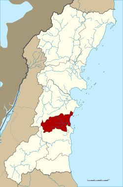 | ||
Thung Tako (Thai: ทุ่งตะโก, [tʰûŋ tā.kōː]) is a district (Amphoe) in the central part of Chumphon Province, southern Thailand.
Contents
Map of Thung Tako District, Chumphon 86220, Thailand
Geography
Neighboring districts are (from the south clockwise) Lang Suan and Sawi of Chumphon Province. To the east is the Gulf of Thailand.
History
The minor districts (King Amphoe) was created on September 6, 1976, when then three tambon Thung Takhrai, Tako and Pak Tako were split off from Sawi district. It was upgraded to a full district on July 19, 1991.
Administration
The district is subdivided into 4 subdistricts (tambon), which are further subdivided into 35 villages (muban). Pak Tako is a subdistrict municipality (thesaban tambon) which covers the same-named tambon. There are further 3 Tambon administrative organizations (TAO).
References
Thung Tako District Wikipedia(Text) CC BY-SA