
Topo map USGS Caples Lake Prominence 101 m Parent range Sierra Nevada | Elevation 2,868 m Mountain range Sierra Nevada | |
 | ||
Similar Red Lake Peak, Ralston Peak, Freel Peak, Pyramid Peak, Mount San Antonio | ||
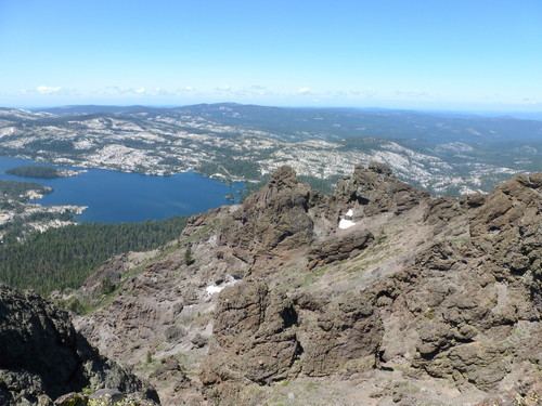
Thunder Mountain in the Sierra Nevada of California is located east of Silver Lake and west of Kirkwood Mountain Resort in the Eldorado National Forest. The mountain has two peaks, the 9,414-foot (2,869 m) main peak and a 9,412-foot (2,869 m) sub-peak west of the main peak. The main summit is the highest point in Amador County. Due to the high elevation, most precipitation that falls on Thunder Mountain consists of snow.
Map of Thunder Mountain, California 95666, USA
The peak was named by United States Forest Service personnel because "thunderstorms appear to build up in that area."
References
Thunder Mountain (Amador County, California) Wikipedia(Text) CC BY-SA