
Easiest route Trail hike, class 1 Prominence 188 m | Topo map USGS Crystal Lake Elevation 2,785 m | |
 | ||
Similar Mount Burnham, South Mount Hawkins, Mount Islip, Mount Baden‑Powell, Waterman Mountain | ||
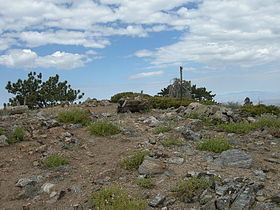
Throop Peak (/ˈtruːp/ TROOP) is a 9,142 feet (2,786 m) peak of the San Gabriel Mountains, in the San Gabriel Mountains National Monument and Angeles National Forest, in Los Angeles County, California.
Contents
Map of Throop Peak, California 91702, USA
The high peak provides views of both the Mojave Desert and the Los Angeles Basin all the way to the ocean. The peak was named for Amos G. Throop, founder of Caltech, formerly called Throop College. The peak marks the northwestern boundary of the Sheep Mountain Wilderness.
AccessEdit
A trailhead for climbing Throop Peak is located at Dawson Saddle along the Angeles Crest Highway. The route goes through a forest of Jeffrey Pine, Sugar Pine, and the high elevation Lodgepole Pine with some White Fir.
Climbing SeasonEdit
The most popular seasons for climbing Throop Peak are Spring and Fall because of the cooler temperatures and easy accessibility.