
Population 496 (2011) Sovereign state United Kingdom Area 13.47 km² | OS grid reference TF 733 434 Post town HUNSTANTON Local time Friday 3:20 AM | |
 | ||
Weather 15°C, Wind S at 19 km/h, 65% Humidity District King's Lynn and West Norfolk | ||
Lazywinds luxury b b thornham norfolk uk
Thornham is a village and civil parish in the English county of Norfolk. It is situated on the north Norfolk coast some 7 kilometres (4.3 mi) north-east of the seaside resort of Hunstanton, 30 km (19 mi) north of the town of King's Lynn and 70 km (43 mi) north-west of the city of Norwich.
Contents
Map of Thornham, UK
The civil parish has an area of 13.47 km2 (5.20 sq mi) and in the 2001 census had a population of 478 in 249 households, including Titchwell and increasing to 496 at the 2011 Census. For the purposes of local government, the parish falls within the district of King's Lynn and West Norfolk.
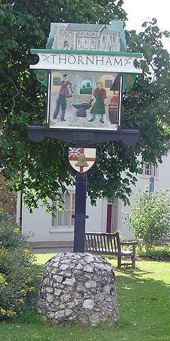
HMS Thornham, a Ham class minesweeper, was named after the village. The ship's bell hangs in All Saints' Church.
Notable landmarks
References
Thornham, Norfolk Wikipedia(Text) CC BY-SA