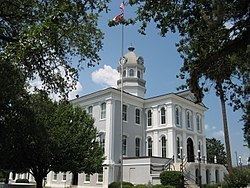
Country United States County Thomas ZIP codes 31700-31799 Elevation 85 m Local time Thursday 7:53 PM | Time zone Eastern (EST) (UTC-5) Area code(s) 229 Population 18,718 (2013) | |
 | ||
Weather 24°C, Wind S at 13 km/h, 59% Humidity Colleges and Universities | ||
Thomasville is the county seat of Thomas County, Georgia, United States. The city is the second largest in Southwest Georgia after Albany.
Contents
- Map of Thomasville GA USA
- History
- Rose Festival
- Culture
- Geography
- Climate
- Demographics
- Thomasville City School District
- Thomas County School District
- Private schools
- Higher education
- Economy
- Municipal broadband network
- Newspaper
- Notable people
- References
Map of Thomasville, GA, USA
The city deems itself the City of Roses and holds an annual Rose Festival. The city features plantations open to the public, a historic downtown, a large farmer's market, and a 308-year-old oak tree at the corner of Monroe and Crawford streets. The population was 19,340 at the 2013 census.
In 2016, Thomasville was featured as the second best historic small town on USA Today's 10 Best List Reader's Choice after Bisbee (Arizona) but ahead of Abingdon (Virginia), Mackinac Island (Michigan), and Astoria (Oregon).
History
Thomasville was founded in 1825 as seat of the newly formed Thomas County. It was incorporated as a town in 1831 and as a city in 1889. The community was named for Jett Thomas, a general in the War of 1812.
Rose Festival
Thomasville plants and maintains more than 1,000 roses located throughout the city, as do a number of residents who have their own rose gardens. During the last week of April, rose growers from all over the world display their prize roses for a panel of judges. The Thomasville Rose Garden at Cherokee Lake Park is the largest of 85 rose beds maintained by the city, and is host to the annual rose festival.
Culture
Thomasville is home to several historic and cultural organizations, including the Thomas County Historical Society and Museum of History, Thomasville Landmarks, Inc. the Thomasville Center for the Arts, Jack Hadley's Black History Museum, and Pebble Hill Plantation. Daily tours and research hours are available at each institution.
Geography
Thomasville is located at 30°50′11″N 83°58′42″W (30.836444, -83.978199).
According to the United States Census Bureau, the city has a total area of 14.9 square miles (39 km2), of which 14.9 square miles (39 km2) is land and 0.1 square miles (0.26 km2) (0.40%) is water. It is the second largest city in Southwest Georgia after Albany. The city has 3 U.S. Route highways: U.S. Route 19, U.S. Route 84,and U.S. Route 319. It is located 34 miles northeast of Tallahassee, Florida, 28 miles southwest of Moultrie, 43 miles west of Valdosta, 95 miles east of Dothan, Alabama, 59 miles south of Albany and 22 miles north of Monticello, Florida.
Climate
The climate in this area is characterized by hot, humid summers and generally mild to cool winters. According to the Köppen Climate Classification system, Thomasville has a humid subtropical climate, abbreviated "Cfa" on climate maps.
Demographics
As of the census of 2000, there were 18,162 people, 7,021 households, and 4,654 families residing in the city. The population density was 1,221.4 people per square mile (471.6/km²). There were 7,788 housing units at an average density of 523.7 per square mile (202.2/km²). The racial makeup of the city was 55.39% African American, 42.83% White, 0.23% Native American, 0.53% Asian, 0.01% Pacific Islander, 0.24% from other races, and 0.78% from two or more races. Hispanic or Latino of any race were 1.28% of the population.
There were 7,021 households out of which 30.8% had children under the age of 18 living with them, 39.7% were married couples living together, 22.7% had a female householder with no husband present, and 33.7% were non-families. 29.7% of all households were made up of individuals and 12.7% had someone living alone who was 65 years of age or older. The average household size was 2.47 and the average family size was 3.06.
In the city, the population was spread out with 26.9% under the age of 18, 8.7% from 18 to 24, 26.8% from 25 to 44, 21.5% from 45 to 64, and 16.2% who were 65 years of age or older. The median age was 36 years. For every 100 females there were 83.3 males. For every 100 females age 18 and over, there were 78.0 males.
The median income for a household in the city was $29,926, and the median income for a family was $37,606. Males had a median income of $28,331 versus 12,312 for females. The per capita income for the city was $15,910. About 15.1% of families and 19.0% of the population were below the poverty line, including 25.1% of those under age 18 and 21.0% of those age 65 or over.
Thomasville City School District
The Thomasville City School District holds pre-school to grade twelve, and consists of three elementary schools, a middle school, and a high school. The district has 204 full-time teachers and over 3,107 students.
Thomas County School District
The Thomas County School District holds pre-school to grade twelve, and consists of three elementary schools, a middle school, and two high schools, Thomas County Central and Bishop Hall Charter School. The district has 329 full-time teachers and over 5,466 students.
Private schools
Higher education
Economy
The bakery company Flowers Foods is based in Thomasville. Senior Life Insurance Company is based in Thomasville.
Municipal broadband network
The city has installed a fiber optic network, known as CNS, which provides affordable, high speed Internet access. The city's network has been in place since 1999. The city transfers excess revenues from CNS services and from its other utilities to the city's general fund to pay for police and fire protection, street maintenance, and other essential services. In 2012, because of these revenues, the city was able to eliminate property fire tax for its residents and businesses.
