
Max. length 1.4 mi (2.3 km) Surface area 533 acres (216 ha) Max depth 20 m Outflow location Sebago Lake | Basin countries United States Max. width 1 mi (1.6 km) Area 216 ha Surface elevation 85 m | |
 | ||
Water volume 10,527 acre·ft (12,985,000 m) | ||
Megan catches the biggest bass once again bass fishing thomas pond raymond me
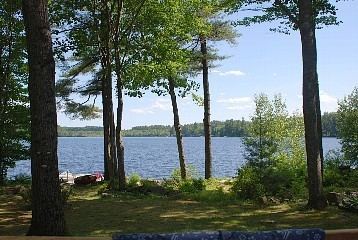
Thomas Pond is adjacent to U.S. Route 302 on the border of Raymond and Casco, Maine. The shoreline is heavily developed with residences and seasonal cabins, and there is a boat launching area near the highway where the pond overflows into Sebago Lake. White perch, chain pickerel, smallmouth bass, and largemouth bass thrive in the shallow portions of the pond; and land-locked Atlantic salmon use the deeper parts of the pond preying on rainbow smelt.
Contents
- Megan catches the biggest bass once again bass fishing thomas pond raymond me
- Map of Thomas Pond Maine USA
- References
Map of Thomas Pond, Maine, USA
References
Thomas Pond Wikipedia(Text) CC BY-SA