
Population 266 (2011) | OS grid reference SE476788 Sovereign state United Kingdom District Hambleton | |
 | ||
Civil parish Thirkleby High and Low with Osgodby Region | ||
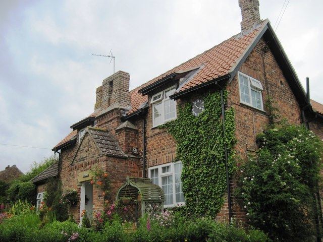
Thirkleby High and Low with Osgodby is a civil parish in the Hambleton district of North Yorkshire, England. The constituents of the parish consist of the villages of Great Thirkleby, Little Thirkleby and the scattered hamlet of Osgodby. The similarly named medieval settlement of Thirkleby Manor is in the parish of Kirby Grindalythe, Ryedale district. The population of the civil parish taken at the 2011 Census was 266.
Contents
- Map of Thirkleby High and Low with Osgodby UK
- History
- Governance
- Geography
- Demography
- Religion
- Notable residents
- References
Map of Thirkleby High and Low with Osgodby, UK
History
The Domesday Book mentions the village of Thirkleby as Turchilebi in the Yarlestre hundred and belonging to the Coxwold manor. There were 54 villagers with the land consisting of ploughed fields and woodland. At the time of the Norman invasion, the lands belonged to Kofse but soon afterwards were granted to Hugh, son of Baldric. Soon after, the manor was in the hands of the Mowbray family and followed the descent of the manor of Thirsk until the 16th century. A mesne lordship was held in the parish by Robert de Buscy in the 12th century, with some land granted to Byland Abbey. The Buscy family held this land until at least 1348. Other land owners in the 12th century in the manor were the Meynell family. Some of their land seemed to have been granted by marriage to the de Burton family, who also held lands in West Harlsey.
The greater manor passed from the Buscy family to the Crown following their involvement in the 1322 uprisings. They were acquired by Sir Thomas Ughtred in 1361. The manor was sold to Sir Roger Fulthorpe in 1383 and remained in the family until the late 16th century when it was seized by the Crown. It was subsequently sold to the Earl of Warwick who sold it in turn to William Frankland. It remained in the Frankland family, though not always through direct line of succession, until the late 19th century.
The lesser manor passed from the de Burton family to Marmaduke Darell in 1363 and thereafter followed the inheritance of the manor of Sessay. The lands that make up Osgodby were those that were granted to the church.
The toponymy is derived from the Danish personal name of Thorkel or Thirkel suffixed with by to give the meaning of Thorkel's farm.
Thirkleby Hall used to stand to the west of Great Thirkleby and was built between 1780 an 1785 for Sir Thomas Frankland, 6th Baronet and was situated in around 200 acres (81 ha) of grounds. At the end of the First World War, the estate was without any heir and was auctioned off, except for the hall which did not find a buyer until 1927 when it was dismantled entirely. The grounds are now used for holiday accommodation in the form of cottages and static caravans.
Prisoner of war camp number 108 was built at Sandhill (on Low Road at the southern edge of Little Thirkleby) as a working camp for German prisoners during World War II. It has been used as a pig farm for many years but the water tower and many of the buildings have survived.
Governance
The village lies within the Thirsk and Malton UK Parliament constituency. It also lies within the Stillington electoral division of North Yorkshire County Council and the White Horse ward of Hambleton District Council.
Geography
The parish is 2,592 acres (1,049 ha) in size. The parish consists of the villages of Great (or High) Thirkleby, Little (or Low) Thirkleby and the scattered hamlet of Osgodby. Thirkleby Beck divides Great and Little Thirkleby and runs south as part of the tributary system of the River Swale. The A19 road passes north westward through the southern part of the parish. The two villages are linked by Arden Bridge which is a Grade II listed structure probably built by John Carr in the 18th century.
The nearest settlements to the centre point of the two villages are Bagby 1.3 miles (2.1 km) to the north west, Kilburn 2.3 miles (3.7 km) to the east, Carlton Husthwaite 1.8 miles (2.9 km) to the south east and Hutton Sessay 1.5 miles (2.4 km) to the south.
Demography
In 1881, the UK Census recorded the population as 261. In 2001 the UK Census recorded a population of 224 of which 47.8% were male and 52.2% were female and 191 were over the age of sixteen years. The 2011 UK Census recorded a population of 266, of which 47.4% were male and 52.6% were female and 232 were over the age of sixteen years. Population density was recorded as 0.2 per hectare.
Religion
The church is a Grade II* listed building, dedicated to All Saints. It was designed by Victorian architect Edward Buckton Lamb and built in 1851 for Lady Frankland-Russell of Thirkleby Park, in memory of her husband Robert. The burial vault of the earlier church was retained but the fine pews were moved to the church of St Andrew's at Blubberhouses (another Frankland-Russell estate church also designed by E.B. Lamb). All Saints has several Frankland memorials and other monumental inscriptions, including a fine piece by the sculptor John Flaxman.
The previous church was rebuilt in 1722 on the site of the original 12th-century building.