
Country United States ZIP codes 92274 Elevation -42.1 m Population 2,865 (2010) | Area code(s) 760 Zip code 92274 Local time Wednesday 10:23 PM | |
 | ||
Weather 21°C, Wind N at 8 km/h, 33% Humidity | ||
Jesus christ appearance on amateur video in thermal california usa
Thermal is an unincorporated community within the Coachella Valley in Riverside County, California located approximately 25 miles (40 km) southeast of Palm Springs and about 9.5 miles (15.3 km) north of the Salton Sea. The community's elevation is 138 feet (42 m) below mean sea level. It is inside area code 760 and is in ZIP Code 92274. The population was 2,865 at the 2010 census. For statistical purposes, the United States Census Bureau has defined Thermal a census-designated place (CDP), which does not precisely correspond to the historical community.
Contents
- Jesus christ appearance on amateur video in thermal california usa
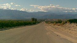
- Map of Thermal CA 92274 USA
- History
- Geography and climate
- Climate
- Demographics
- Education
- Transportation
- Cemeteries
- The Thermal Club
- References
Map of Thermal, CA 92274, USA
History
Thermal (originally Kokell) began as a railroad camp in 1910 for employees of the Southern Pacific Railroad, followed by Mecca (originally called Walters) in 1915 and Arabia in between, each with about 1,000 residents. Permanent dwellings were soon established on Avenue 56 (renamed Airport Boulevard), former U.S. Route 99 (State Route 86) and State Route 111 by the 1930s.
Agricultural development from canal irrigation made the area thrive in greenery by the 1950s, followed by the former Camp Young U.S. Naval Air station converted into Thermal Airport by 1965. In the early 1990s, a four-lane highway (State Route 86) was constructed over an earlier transportation route. There is a proposal for a major commercial aviation Airport known as the Jackie Cochran-Desert Cities Regional Airport in the same site.
An auto racetrack and club, a members-only racetrack near Jacqueline Cochran Regional Airport (Thermal Club), is under development, and is being built on land originally owned by the Kohl family (owners of Kohl Department stores) and built in partnership with them. The Kohls still own significant property in this area.
Geography and climate
According to the United States Census Bureau, the CDP covers an area of 9.5 square miles (25.5 km²), all of it land.
Climate
Thermal has a desert climate (BWh according to the Köppen climate classification). High mountain ranges on three sides contribute to its unique and year-round warm climate, with some of the warmest winters west of the Rocky Mountains. Its average annual high temperature is 89.5 °F (31.9 °C) and its average annual low is 62.1 °F (16.7 °C). Summer highs above 108 °F (42 °C) are common and sometimes exceed 120 °F (49 °C), while summer night lows often stay above 82 °F (28 °C). Winters are warm with daytime highs often between 68–86 °F (20–30 °C). The average annual precipitation is under 4 inches (100 mm), with over 348 days of sunshine per year. The hottest temperature ever recorded in the area was 125 °F (52 °C) on July 6, 1905. The mean annual temperature is 75.8 °F (24.3 °C).
Demographics
The 2010 United States Census reported that Thermal had a population of 2,865. The population density was 303.1 people per square mile (117.0/km²). The racial makeup of Thermal was 1,034 (36.1%) White, 28 (1.0%) African American, 30 (1.0%) Native American, 32 (1.1%) Asian, 1 (0.0%) Pacific Islander, 1,685 (58.8%) from other races, and 55 (1.9%) from two or more races. Hispanic or Latino of any race were 2,730 persons (95.3%).
The Census reported that 2,863 people (99.9% of the population) lived in households, 2 (<0.1%) lived in non-institutionalized group quarters, and 0 (0%) were institutionalized.
There were 684 households, out of which 452 (66.1%) had children under the age of 18 living in them, 410 (59.9%) were opposite-sex married couples living together, 113 (16.5%) had a female householder with no husband present, 87 (12.7%) had a male householder with no wife present. There were 61 (8.9%) unmarried opposite-sex partnerships, and 6 (0.9%) same-sex married couples or partnerships. 55 households (8.0%) were made up of individuals and 19 (2.8%) had someone living alone who was 65 years of age or older. The average household size was 4.19. There were 610 families (89.2% of all households); the average family size was 4.36.
The population was spread out with 1,070 people (37.3%) under the age of 18, 316 people (11.0%) aged 18 to 24, 781 people (27.3%) aged 25 to 44, 502 people (17.5%) aged 45 to 64, and 196 people (6.8%) who were 65 years of age or older. The median age was 25.9 years. For every 100 females there were 111.6 males. For every 100 females age 18 and over, there were 109.5 males.
There were 761 housing units at an average density of 80.5 per square mile (31.1/km²), of which 269 (39.3%) were owner-occupied, and 415 (60.7%) were occupied by renters. The homeowner vacancy rate was 0.7%; the rental vacancy rate was 6.7%. 1,162 people (40.6% of the population) lived in owner-occupied housing units and 1,701 people (59.4%) lived in rental housing units.
Education
There are several schools in the Coachella Valley Unified School District that are in and near the community. These include schools in Salton City, 20 miles south of Coachella, in Imperial County, California. In Thermal, they are: Westside Elementary (K-6), Oasis Elementary (K-8), Mountain Vista Elementary (K-6), Saul Martinez Elementary (K-6), Mecca Elementary (K-6), Edward Park Elementary (K-5), Toro Canyon Middle (6-8), Bobby Duke Middle (6-8), John Kelley Elementary (K-6), Coachella Valley High (9-12), Cesar Chavez Elementary (K-6), Cahuilla Desert Academy (Junior High: 7th and 8th grade), Desert Mirage High School (9-12), West Shores High School (9-12) and La Familia Continuation High (9-12).
College of the Desert, a community college based in Palm Desert has opened a new satellite campus, the East Valley Educational Center, on the corner of 62nd Avenue and Buchanan Street.
Transportation
Thermal Airport is located about 1.6 miles southwest of the community. The Union Pacific Railroad owns and operates the former Southern Pacific Railroad mainline through Thermal.
The region is served by a two-lane Expressway. State Route 86/111 is a modern transportation corridor that serves as a fruit shipping and international trucking route to connect with Interstate 10 in Indio.
Cemeteries
The Toro Cemetery is located on Monroe Street.
The Torres-Martinez Desert Cahuilla Indians maintain a small (48 interments) cemetery on Martinez Road.
The Thermal Club
The Thermal Club is a private motorsports facility situated on 344 acres (139 ha) south of Thermal. This private country club for automotive enthusiasts plans to build a 4.5-mile motor racing circuit (7,200 m) with 300 lots for member-owned garages and villas. As of 2014 the first 1.8-mile racing course (2,900 m) was in use by early members and for media and promotional events with 2 more courses planned. http://www.thethermalclub.com/