
OS grid reference SO525065 Country Wales Postcode district NP25 Local time Wednesday 10:40 AM | Sovereign state United Kingdom Dialling code 01600 | |
 | ||
Weather 9°C, Wind NW at 11 km/h, 67% Humidity | ||
Local wildlife site the narth
The Narth (Welsh: Pennarth) is a village in Monmouthshire, Wales. It is located about 6 miles (9.7 km) south of Monmouth, and about 2 miles (3.2 km) east of Trellech, on a spur of land overlooking the Whitebrook and Wye valleys.
Contents
- Local wildlife site the narth
- Map of The Narth Monmouth UK
- The narth relaxing sounds of nature
- History and amenities
- References
Map of The Narth, Monmouth, UK
The narth relaxing sounds of nature
History and amenities
The village developed initially through settlement on waste land, principally by workers in paper mills in Whitebrook in the nineteenth century. In the 1920s, land was offered for sale by the owner, the Marquis of Worcester, and development continued on a sporadic basis until the late twentieth century. Old cottages were refurbished and many larger houses were built. The village is popular with commuters.
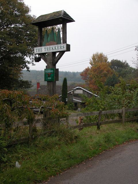
A village school opened in 1910, but closed later in the century. The Trekkers opened in the early 1970s as a trekking centre, and operated as a private members' club until 1984; thereafter it was run as a pub, housed in a log cabin, until it closed in 2004. It has since been demolished. Community activity is centred on the village hall.