
Country Vietnam Capital Thanh Sơn Area 1,309 km² Local time Thursday 8:31 PM | Region Northeast Time zone UTC + 7 (UTC+7) Province Phu Tho Province | |
 | ||
Weather 24°C, Wind E at 14 km/h, 89% Humidity | ||
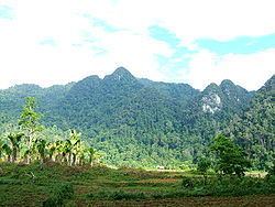
Thanh Sơn is a rural district of Phú Thọ Province in the Northeast region of Vietnam. The Xuân Sơn National Park lies within the district. As of 2003, the district had a population of 187,700. The district covers an area of 1309 km². The district capital lies at Thanh Sơn.
Contents
Map of Thanh S%C6%A1n District, Phu Tho Province, Vietnam
Administrative divisions
Thanh Sơn, Sơn Hùng, Địch Quả, Giáp Lai, Thục Luyện, Võ Miếu, Thạch Khoán, Cự Thắng, Tất Thắng, Văn Miếu, Cự Đồng, Thắng Sơn, Tân Minh, Hương Cần, Khả Cửu, Tân Lập,Đông Cửu, Yên Lãng, Yên Lương, Thượng Cửu, Lương Nha,Yên Sơn, Tinh Nhuệ.
References
Thanh Sơn District Wikipedia(Text) CC BY-SA