
Length 15 mi (24 km) Designation Long Distance Footpath | Location Greater London, Surrey | |
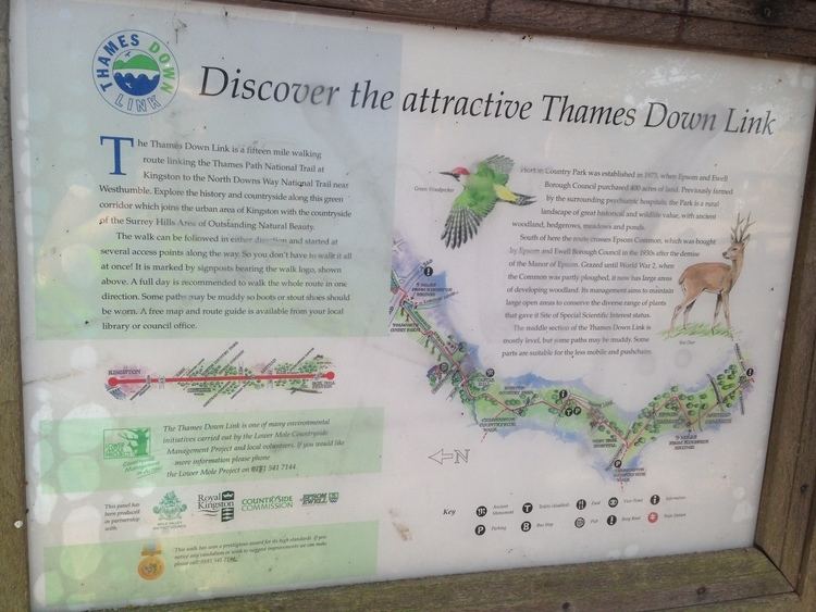 | ||
Trailheads Kingston BridgeBox Hill station Highest point Mickleham Downs, 137 m (449 ft) Lowest point Kingston Bridge, 10 m (33 ft) | ||
The Thames Down Link is a 24 km (15 mi) official walking route linking the Thames Path and the North Downs Way.
Name
The path is so called as it connects the River Thames with the North Downs, the hill range which is to the south as far as the western border of Surrey.
References
Thames Down Link Wikipedia(Text) CC BY-SA